
IMAGES TAKEN NEAR TO
Dawes Way, NOTTINGHAM, NG7 2AW
Introduction
This page details the photographs taken nearby to Dawes Way, NG7 2AW by members of the Geograph project.
The Geograph project started in 2005 with the aim of publishing, organising and preserving representative images for every square kilometre of Great Britain, Ireland and the Isle of Man.

There are currently over 7.5m images from over14,400 individuals and you can help contribute to the project by visiting https://www.geograph.org.uk
Image Map
Images are licensed for reuse under creativecommons.org/licenses/by-sa/2.0
Notes
- Clicking on the map will re-center to the selected point.
- The higher the marker number, the further away the image location is from the centre of the postcode.
Image Listing (138 Images Found)
Images are licensed for reuse under creativecommons.org/licenses/by-sa/2.0
Image
Details
Distance
1
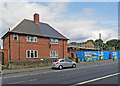
Ilkeston Road: social housing old and new
Nottingham City Homes is developing a site west of the corner of Ilkeston Road and Hopedale Close. On the left is one of the Garden City council houses built in huge numbers before and after the Second World War.
Image: © John Sutton
Taken: 24 Aug 2017
0.02 miles
2
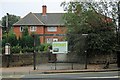
Radford: We're all proud of Nottingham
So reads the poster on the city-bound Faraday Road bus stop at the bottom of Ilkeston Road (and Nottinghamians should certainly be proud of their bus service, Nottingham City Transport). In the background is a small square of typical City of Nottingham council houses of the kind built either side of the Second World War.
Image: © John Sutton
Taken: 16 Sep 2014
0.02 miles
3
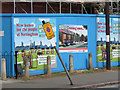
New homes for the people of Nottingham
"Building a better Nottingham" and "Creating homes and places where people want to live" according to Nottingham City Homes, which is building social housing on the Hopedale Close site on Ilkeston Road. For the context, see Image
Image: © John Sutton
Taken: 24 Aug 2017
0.02 miles
4
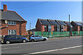
New houses on Ilkeston Road
Image: © John Sutton
Taken: 5 May 2018
0.02 miles
5
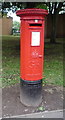
George V postbox on Ilkeston Road, Radford
Postbox No. NG7 43.
Image: © JThomas
Taken: 9 Jul 2016
0.02 miles
6
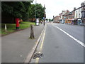
Ilkeston Road, Radford
Looking east showing position of Postbox No. NG7 43.
Image: © JThomas
Taken: 9 Jul 2016
0.02 miles
7
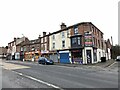
Businesses on Ilkeston Road, Nottingham
At the junction with Bright Street.
Image: © Andrew Abbott
Taken: 31 Jan 2021
0.03 miles
8
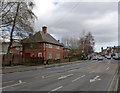
Council houses on Ilkeston Road
A small infill group of just 11 houses in the distinctive architectural style of Nottingham's council houses from the late 1930s.
There is a bench mark http://www.geograph.org.uk/photo/3853172 on the side wall of the side gateway of the nearest house.
Image: © Alan Murray-Rust
Taken: 16 Feb 2014
0.04 miles
10
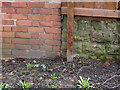
Bench mark, 336 Ilkeston Road
See http://www.geograph.org.uk/photo/3853178 for location.
Image: © Alan Murray-Rust
Taken: 16 Feb 2014
0.04 miles