IMAGES TAKEN NEAR TO
Church Road, NOTTINGHAM, NG6 8TN
Introduction
This page details the photographs taken nearby to Church Road, NG6 8TN by members of the Geograph project.
The Geograph project started in 2005 with the aim of publishing, organising and preserving representative images for every square kilometre of Great Britain, Ireland and the Isle of Man.

There are currently over 7.5m images from over14,400 individuals and you can help contribute to the project by visiting https://www.geograph.org.uk
Image Map
Images are licensed for reuse under creativecommons.org/licenses/by-sa/2.0
Notes
- Clicking on the map will re-center to the selected point.
- The higher the marker number, the further away the image location is from the centre of the postcode.
Image Listing (48 Images Found)
Images are licensed for reuse under creativecommons.org/licenses/by-sa/2.0
Image
Details
Distance
1
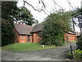
St, Mark's church, Bestwood Village
Designed by J. Medland Taylor https://manchestervictorianarchitects.org.uk/architects/james-medland-taylor 1886-7.
Image: © Jonathan Thacker
Taken: 31 Mar 2022
0.04 miles
2
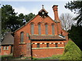
St. Mark's church, Bestwood Village
Designed by J. Medland Taylor https://manchestervictorianarchitects.org.uk/architects/james-medland-taylor 1886-7.
Image: © Jonathan Thacker
Taken: 31 Mar 2022
0.04 miles
3
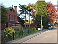
Nottingham - NG6 (Bestwood Village)
School Walk in Bestwood Village houses the local Primary School and the Anglican church. St Mark’s was opened in 1887 to serve an area that grew out of the work of the Bestwood Coal and Iron Company, founded in 1872. The company built the colliery, the associated offices, most of the houses in the village, the school, the ironworks and finally, the church. The Duke of St Albans donated the half acre of land close to the school room and the cemetery, both of which he had already given in 1885. Prior to this, between 1877-85, a service was conducted on Sundays, firstly in the colliery school room and later on, in the school proper. The church was re-ordered in 2009 to bring it up to modern standards and it is now part of a team ministry with several other local churches.
Image: © David Hallam-Jones
Taken: 16 May 2012
0.04 miles
4
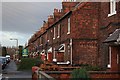
Park Road
Housing built for the miners at the nearby Bestwood Colliery. Each pair of the houses contains a protruding brick motif alternately depicting the owners initials B.C.I. (Bestwood Coal and Iron Company) and the date of construction 1876.
Image: © Mick Garratt
Taken: 5 Jan 2008
0.05 miles
5
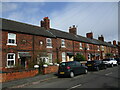
Former colliery housing, Bestwood Village
Image: © Jonathan Thacker
Taken: 31 Mar 2022
0.05 miles
6
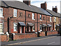
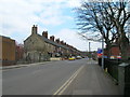
Bestwood - mid-terrace houses on Park Road
Alternate houses in this terrace bear a "1867" and "BICC" stone motif - see Image and Image These houses were built in 1867 by the Bestwood Iron and Coal Company.
Image: © Dave Bevis
Taken: 5 Oct 2013
0.05 miles
7
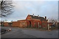
Bestwood Village Hall
The original building built in the distinctive style of the colliery owners, the Bestwood Coal and Iron Company.
Image: © Mick Garratt
Taken: 5 Jan 2008
0.06 miles
8
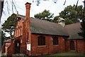
St. Mark's Church
Built in 1887. Another of the many buildings in the village which distinctive style indicates it was built by the colliery owners, the Bestwood Coal and Iron Company for the benefit of their employees.
Image: © Mick Garratt
Taken: 5 Jan 2008
0.06 miles
9
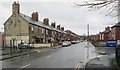
Bestwood Colliery Village: Park Road
The terraces on the left were built by the Bestwood Coal & Iron Company in 1876, and are dated and monogrammed on the first floor (see Image] and Image]). The first pair of cottages is faced with Bulwell stone, but the rest are red brick.
Image: © John Sutton
Taken: 7 Apr 2014
0.06 miles