
IMAGES TAKEN NEAR TO
Filey Street, NOTTINGHAM, NG6 8EJ
Introduction
This page details the photographs taken nearby to Filey Street, NG6 8EJ by members of the Geograph project.
The Geograph project started in 2005 with the aim of publishing, organising and preserving representative images for every square kilometre of Great Britain, Ireland and the Isle of Man.

There are currently over 7.5m images from over14,400 individuals and you can help contribute to the project by visiting https://www.geograph.org.uk
Image Map
Images are licensed for reuse under creativecommons.org/licenses/by-sa/2.0
Notes
- Clicking on the map will re-center to the selected point.
- The higher the marker number, the further away the image location is from the centre of the postcode.
Image Listing (51 Images Found)
Images are licensed for reuse under creativecommons.org/licenses/by-sa/2.0
Image
Details
Distance
1
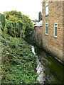
River Leen
A quick glimpse from the Carey Road bridge. The buildings on the right show the colour of the local Bulwell sandstone to good advantage.
Image: © Alan Murray-Rust
Taken: 27 Aug 2009
0.00 miles
2

Carey Road junction with Main Street
Currently undergoing a complete rebuild, resulting in the temporary closure of Carey Road, seen in the background here. This has necessitated a significant diversion to one of the main bus routes into Bulwell.
Image: © Alan Murray-Rust
Taken: 27 Aug 2009
0.02 miles
3

Leon's Chippy plus . . .
A distinctive pair of gabled houses on Main Street, Bulwell.
Image: © Alan Murray-Rust
Taken: 27 Aug 2009
0.05 miles
4

St Mary's School, Main Street
There is an OS benchmark Image on the bottom light-coloured quoin right of the near doorway, at the junction with the stone wall
Image: © Roger Templeman
Taken: 28 Nov 2017
0.05 miles
5

Benchmark on St Mary's School
Ordnance Survey cut mark benchmark described on the Bench Mark Database at http://www.bench-marks.org.uk/bm91702
Image: © Roger Templeman
Taken: 28 Nov 2017
0.05 miles
6

Carey Road junction with Main Street
Currently undergoing a complete rebuild, resulting in the temporary closure of Carey Road. This has necessitated a significant diversion to one of the main bus routes into Bulwell.
Image: © Alan Murray-Rust
Taken: 27 Aug 2009
0.05 miles
7
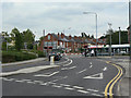
Carey Road level crossing
Shared by NET trams and Robin Hood Line trains. The barriers are only necessary because of the presence of the railway; otherwise standard highway traffic lights would have been sufficient.
Image: © Alan Murray-Rust
Taken: 27 Aug 2009
0.05 miles
8
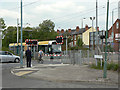
Carey Road level crossing
Shared by NET trams and Robin Hood Line trains. The barriers are only necessary because of the presence of the railway; otherwise standard highway traffic lights would have been sufficient.
Image: © Alan Murray-Rust
Taken: 27 Aug 2009
0.06 miles
9

Nottingham, NG6 - Bulwell
The St Mary's Church of England (Voluntary Assisted) Primary & Nursery School with a roll of 300 pupils is seen here at the junction of Main Street and Ragdale Road. The "KFC" fast food outlet in the distance is on the edge of the Springfield Retail Park and equally close to the Bulwell Forest stop on the Nottingham Express Tram route.
Image: © David Hallam-Jones
Taken: 15 Dec 2012
0.06 miles
10
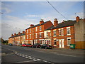
Terraced housing on Hucknall Lane, Bulwell
Most of this part of Hucknall Lane is lined with commercial premises of some form; this row of terraced houses (in a few contrasting styles) therefore stands out, particularly when caught by the low evening sunshine.
Image: © Richard Vince
Taken: 15 Sep 2012
0.08 miles