
IMAGES TAKEN NEAR TO
Gayhurst Road, NOTTINGHAM, NG6 0BZ
Introduction
This page details the photographs taken nearby to Gayhurst Road, NG6 0BZ by members of the Geograph project.
The Geograph project started in 2005 with the aim of publishing, organising and preserving representative images for every square kilometre of Great Britain, Ireland and the Isle of Man.

There are currently over 7.5m images from over14,400 individuals and you can help contribute to the project by visiting https://www.geograph.org.uk
Image Map
Images are licensed for reuse under creativecommons.org/licenses/by-sa/2.0
Notes
- Clicking on the map will re-center to the selected point.
- The higher the marker number, the further away the image location is from the centre of the postcode.
Image Listing (20 Images Found)
Images are licensed for reuse under creativecommons.org/licenses/by-sa/2.0
Image
Details
Distance
2
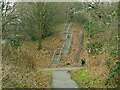
The site of Marble Arch
This was the local name given to a farm track accommodation bridge under the railway, later providing pedestrian access into Bestwood Estate. It was a tall narrow brick arch of similar proportions to the central opening of the London monument, hence the name. It was quite dark and was demolished following the closure of the railway, the line of which is now the Hucknall Road Walkway. The Walkway is a multi-user route; there is an alternative ramp to the left of the embankment - cyclists don't have to use the steps!
Image: © Alan Murray-Rust
Taken: 8 Feb 2022
0.14 miles
3
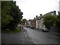
Park Lane, Basford
Looking north from the south eastern end of Brooklyn Road.
Image: © Richard Vince
Taken: 11 Jun 2013
0.15 miles
4

Great Northern Railway bridge, Park Lane, Basford
The trackbed of the Great Northern line to Derby has been partly filled in to make a small playground. The curious-looking parapet was a British Railways replacement for the wrought-iron original and rather remarkably dates from 1965 - a year after passenger services ceased and only two years before the line was abandoned completely. Basford North station was to the left and the Basford East junctions, leading to where the GNR met the Great Central main line, the southbound line via the "Rathole" tunnel, were to the right. The other side of this bridge appears, under the footbridge, in Ben Brooksbank's 1963 pictures Image] and Image My father always called this "Dobby Bridge", but I've no idea why, or if anyone else did, or of the name's origin.
Image: © John Sutton
Taken: 25 Aug 2010
0.17 miles
5

East from Park Lane bridge
This view eastwards from Park Lane bridge shows how the course of the former Great Northern Railway line from Nottingham to Derby Friargate has been obliterated since it closed in 1968. Ben Brooksbank's Image] shows what the lines east of here looked like in the days of steam; the position of the engine in that picture was just beyond the houses straight ahead.
Image: © John Sutton
Taken: 6 May 2011
0.17 miles
6
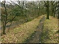
Alongside the Hucknall Road Walkway
The walkway is in the bottom of the railway cutting, which typically has been populated with sycamore trees. However, the top of the bank retains a line of mature oak trees which formed a windbreak alongside Hucknall Road prior to the construction of the railway in the late 19th century.
Image: © Alan Murray-Rust
Taken: 8 Feb 2022
0.18 miles
7
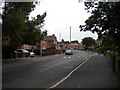
Saxondale Drive, Basford
Looking north east from the junction with Brooklyn Road. The houses are typical of inter war council housing in Nottingham.
Image: © Richard Vince
Taken: 11 Jun 2013
0.18 miles
8
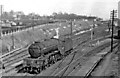
A V2 2-6-2 approaching Basford North station from Nottingham Victoria
View eastward on the ex-Great Northern lines, towards Daybrook and Colwick ahead under the bridge carrying the ex-Great Central main line from Nottingham Victoria to Sheffield; Basford North (former Basford & Bulwell) station is behind the camera. The locomotive is Gresley V2 2-6-2 No. 60878 on the loop towards Bagthorpe Junction and Nottingham Victoria.
Image: © Ben Brooksbank
Taken: 28 Mar 1956
0.19 miles
9
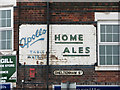
Apollo Table Waters and Home Ales
Old Basford is a good place for old painted signs on former Home Brewery Company off licences. This example, on the corner of Park Lane and Cheltenham Street, is the traditional version, advertising Apollo fizzy drinks and the Daybrook brew; on nearby Arnold Road the beer-off sports the 1960s version - see Image
Image: © John Sutton
Taken: 6 May 2011
0.20 miles
10
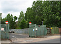
Arnold Road: where the Great Central was
The line of trees marks the former course of the Great Central main line from Nottingham Victoria to Sheffield and Manchester, which crossed Arnold Road on a bridge just to the right. This was a good spot for trainspotting, with traffic on the GC and also the GN Derby Friargate line. Derby-bound trains took the Bagthorpe West Curve, which crossed Arnold Road a little way down the hill to the left (see Image]); when the smoke of those from Derby was spotted away to the left, beyond the sidings where the depot behind these railings is, there was a frantic dash under the GC bridge to the right to see them emerge from the short "Rathole" tunnel which had brought them under the GN Back Line to Daybrook and Colwick and the GC - they then passed under Arnold Road on their way along the single-track Bagthorpe East Curve, whose route is echoed by the northern end of Fenton Road, which was built after the railway was closed and its cuttings and embankments filled or levelled, landscaped or built on.
Image: © John Sutton
Taken: 21 Jun 2011
0.21 miles