The site of Marble Arch
Introduction
The photograph on this page of The site of Marble Arch by Alan Murray-Rust as part of the Geograph project.
The Geograph project started in 2005 with the aim of publishing, organising and preserving representative images for every square kilometre of Great Britain, Ireland and the Isle of Man.

There are currently over 7.5m images from over 14,400 individuals and you can help contribute to the project by visiting https://www.geograph.org.uk
The site of Marble Arch
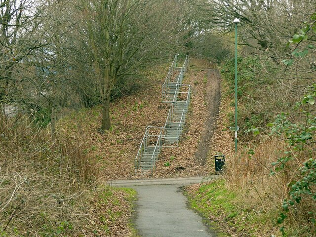
Image: © Alan Murray-Rust Taken: 8 Feb 2022
This was the local name given to a farm track accommodation bridge under the railway, later providing pedestrian access into Bestwood Estate. It was a tall narrow brick arch of similar proportions to the central opening of the London monument, hence the name. It was quite dark and was demolished following the closure of the railway, the line of which is now the Hucknall Road Walkway. The Walkway is a multi-user route; there is an alternative ramp to the left of the embankment - cyclists don't have to use the steps!
Images are licensed for reuse under creativecommons.org/licenses/by-sa/2.0
Image Location
Latitude
52.994439
Longitude
-1.177108