
IMAGES TAKEN NEAR TO
Cadlan Court, NOTTINGHAM, NG5 9HB
Introduction
This page details the photographs taken nearby to Cadlan Court, NG5 9HB by members of the Geograph project.
The Geograph project started in 2005 with the aim of publishing, organising and preserving representative images for every square kilometre of Great Britain, Ireland and the Isle of Man.

There are currently over 7.5m images from over14,400 individuals and you can help contribute to the project by visiting https://www.geograph.org.uk
Image Map
Images are licensed for reuse under creativecommons.org/licenses/by-sa/2.0
Notes
- Clicking on the map will re-center to the selected point.
- The higher the marker number, the further away the image location is from the centre of the postcode.
Image Listing (10 Images Found)
Images are licensed for reuse under creativecommons.org/licenses/by-sa/2.0
Image
Details
Distance
1
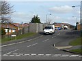
Edern Close
This 1970s development is based on segregation of pedestrian and vehicle access, so this road serves the backs of its adjoining houses.
Image: © Alan Murray-Rust
Taken: 15 Mar 2009
0.16 miles
2
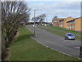
Parkview Drive
1970s housing development in North Nottingham
Image: © Alan Murray-Rust
Taken: 15 Mar 2009
0.17 miles
4
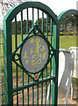
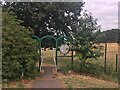
Entrance to Southglade Park
The little disc below the round panel states:
"Designed by"
Jessica age 6
Robin Hood Infants
School
Image: © Alan Murray-Rust
Taken: 15 Mar 2009
0.19 miles
5

Southglade park
East end of the park looking towards Parkview Drive
Image: © Alan Murray-Rust
Taken: 15 Mar 2009
0.19 miles
7
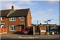
#84 Beckhampton Road
Ordnance Survey documents indicate that a benchmark levelled at 92.702m above Newlyn Datum was verified on the side of the house at its front corner
Image: © Roger Templeman
Taken: 29 Nov 2017
0.23 miles
8
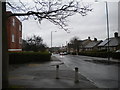
Beckhampton Road, Bestwood Park estate
Beckhampton Road traverses Bestwood Park estate basically from north to south, but winds around so much on the way that this view was taken facing almost due west. The housing on the right, including some bungalows, is typical of this part of the estate, which was built in the 1950s if memory serves. The flats on the left are of more recent construction, and probably date from the same period as the shopping precinct immediately to their east (see Image).
Image: © Richard Vince
Taken: 13 Apr 2013
0.24 miles
9
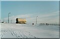
Bus on Parkview Road – 1982
Sunshine following a substantial snowfall.
The bus is City of Nottingham Transport 666, a Leyland Atlantean with Northern Counties bodywork, new in 1978. The body was designed as a new version of the standard Nottingham style https://www.geograph.org.uk/photo/7545914 with several new features, but remained a one-off.
This is one of a series of views featuring buses in the 60s, 70s, and 80s. http://www.geograph.org.uk/search.php?i=137652761
Image: © Alan Murray-Rust
Taken: 11 Jan 1982
0.24 miles
10
South end of Old Farm Road, Top Valley
Image: © Richard Vince
Taken: 11 Jun 2013
0.24 miles