Beckhampton Road, Bestwood Park estate
Introduction
The photograph on this page of Beckhampton Road, Bestwood Park estate by Richard Vince as part of the Geograph project.
The Geograph project started in 2005 with the aim of publishing, organising and preserving representative images for every square kilometre of Great Britain, Ireland and the Isle of Man.

There are currently over 7.5m images from over 14,400 individuals and you can help contribute to the project by visiting https://www.geograph.org.uk
Beckhampton Road, Bestwood Park estate
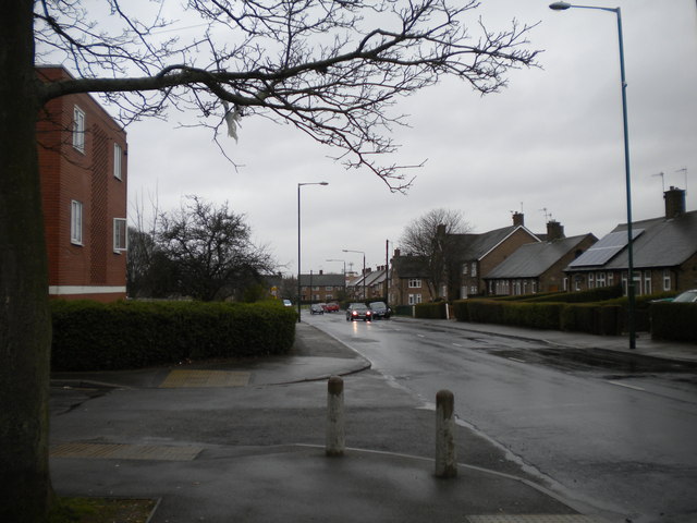
Image: © Richard Vince Taken: 13 Apr 2013
Beckhampton Road traverses Bestwood Park estate basically from north to south, but winds around so much on the way that this view was taken facing almost due west. The housing on the right, including some bungalows, is typical of this part of the estate, which was built in the 1950s if memory serves. The flats on the left are of more recent construction, and probably date from the same period as the shopping precinct immediately to their east (see Image).
Images are licensed for reuse under creativecommons.org/licenses/by-sa/2.0
Image Location
Latitude
53.002933
Longitude
-1.157724