
IMAGES TAKEN NEAR TO
Hadston Drive, NOTTINGHAM, NG5 8UH
Introduction
This page details the photographs taken nearby to Hadston Drive, NG5 8UH by members of the Geograph project.
The Geograph project started in 2005 with the aim of publishing, organising and preserving representative images for every square kilometre of Great Britain, Ireland and the Isle of Man.

There are currently over 7.5m images from over14,400 individuals and you can help contribute to the project by visiting https://www.geograph.org.uk
Image Map
Images are licensed for reuse under creativecommons.org/licenses/by-sa/2.0
Notes
- Clicking on the map will re-center to the selected point.
- The higher the marker number, the further away the image location is from the centre of the postcode.
Image Listing (24 Images Found)
Images are licensed for reuse under creativecommons.org/licenses/by-sa/2.0
Image
Details
Distance
2
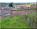
Arnold, Notts (Redhill Area)
The public footpath from Lime Lane (in the Dorket Head area), running towards the Redhill area of Arnold, was obstructed until recently due to the construction of the new "Point" housing estate. Here the right of way has been re-established, albeit that the footpath has not yet been reconstructed. A new tarmac road commences near here and joins Ellington Road.
Image: © David Hallam-Jones
Taken: 12 Jul 2012
0.13 miles
3
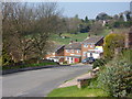
Georgia Drive, Arnold
A residential street at the edge of the main built up area.
Image: © Andrew Hill
Taken: 17 Apr 2010
0.16 miles
4
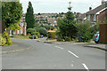
Pentwood Avenue
Part of the Lodge Farm estate of the 1980s.
Image: © Alan Murray-Rust
Taken: 6 Jul 2010
0.17 miles
5
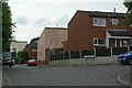
Sutton Road
1970s housing development off Calverton Road
Image: © Alan Murray-Rust
Taken: 6 Jul 2010
0.20 miles
6
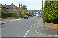
Lodge Farm Road
Developed from a farm lane into housing in the 1980s.
Image: © Alan Murray-Rust
Taken: 6 Jul 2010
0.20 miles
7

Arnold, Notts (Redhill Area)
At this point the public footpath from Lime Lane (Dorket Head area) running towards the Redhill area of Arnold is unobstructed. The distant building construction work on the newly named "Point" Estate meant a temporary suspension of the right of way.
Image: © David Hallam-Jones
Taken: 12 Jul 2012
0.21 miles
8
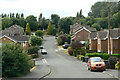
Georgia Drive, near Lodge Farm Lane
Part of the Lodge Farm estate of the 1980s.
Image: © Alan Murray-Rust
Taken: 6 Jul 2010
0.21 miles
9
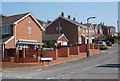
Houldsworth Rise, Arnold
A residential street, the "Rise" being an appropriate name in this instance.
Image: © Andrew Hill
Taken: 17 Apr 2010
0.22 miles
10
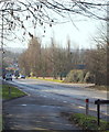
Arch Hill & Mansfield Road, Redhill, Notts
With the hamlet of Red Hill, Redhill, behind the photographer, this is Arch Hill/Mansfield Road (i.e. the A60) ascending towards the suburb of Redhill. Also behind the photographer is the Leapool Allotment site that is owned by Gedling Borough Council. These are situated on the other side of the road bridge that straddles the A60 behind the photographer, approx 100yds away.
Image: © David Hallam-Jones
Taken: 16 Feb 2014
0.22 miles