
IMAGES TAKEN NEAR TO
Moyra Drive, NOTTINGHAM, NG5 6FH
Introduction
This page details the photographs taken nearby to Moyra Drive, NG5 6FH by members of the Geograph project.
The Geograph project started in 2005 with the aim of publishing, organising and preserving representative images for every square kilometre of Great Britain, Ireland and the Isle of Man.

There are currently over 7.5m images from over14,400 individuals and you can help contribute to the project by visiting https://www.geograph.org.uk
Image Map
Images are licensed for reuse under creativecommons.org/licenses/by-sa/2.0
Notes
- Clicking on the map will re-center to the selected point.
- The higher the marker number, the further away the image location is from the centre of the postcode.
Image Listing (8 Images Found)
Images are licensed for reuse under creativecommons.org/licenses/by-sa/2.0
Image
Details
Distance
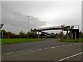
2
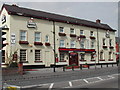
Old Spot Public House
On the Mansfield Road at Daybrook
Image: © Tom Courtney
Taken: 14 Apr 2004
0.15 miles
3
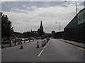
Mansfield Rd, Daybrook
Showing St Paul's Church and the square tower of the Old Home Brewery. At present they are re-surfacing the road ( A60 ).
Image: © Tom Courtney
Taken: 9 Aug 2005
0.15 miles
4
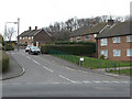
Mosswood Crescent
Part of a large council development of the postwar period.
Image: © Alan Murray-Rust
Taken: 15 Mar 2009
0.23 miles
5
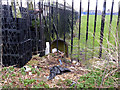
Boundary Marker, off Sherbrook Road
A scruffy view of the rear of one of the standard Nottingham cast-iron boundary markers. It is in a school playing field which makes it difficult to get to the front of it.
Image: © Alan Murray-Rust
Taken: 18 Mar 2014
0.23 miles
6
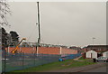
Daybrook, Nottingham, NG5
Construction work on a new 'economy supermarket' site on the former White Hart pub is seen here from Home Close. Home Close is a cul-de-sac and beyond the parked car terminates at the main entrance to Arnbrook Primary School. Ahead, the path empties out onto Oxclose Lane.
Image: © David Hallam-Jones
Taken: 21 Nov 2014
0.23 miles
7
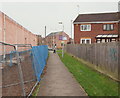
Daybrook, Nottingham, NG5
Home Close lies behind the photographer. This footpath at the side of a supermarket construction site - on land previously occupied by the former White Hart pub - empties out onto Oxclose Lane. The ground floor of the building ahead on Mansfield Road (the A60) was occupied by a Job Centre until mid-2014.
Image: © David Hallam-Jones
Taken: 21 Nov 2014
0.25 miles
8
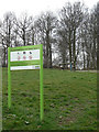
Mosswood Crescent Open Space
Primarily a small stand of mature hardwoods, with a small amount of open area and a rudimentary playground.
Image: © Alan Murray-Rust
Taken: 15 Mar 2009
0.25 miles