
IMAGES TAKEN NEAR TO
Haverhill Crescent, NOTTINGHAM, NG5 5AW
Introduction
This page details the photographs taken nearby to Haverhill Crescent, NG5 5AW by members of the Geograph project.
The Geograph project started in 2005 with the aim of publishing, organising and preserving representative images for every square kilometre of Great Britain, Ireland and the Isle of Man.

There are currently over 7.5m images from over14,400 individuals and you can help contribute to the project by visiting https://www.geograph.org.uk
Image Map
Images are licensed for reuse under creativecommons.org/licenses/by-sa/2.0
Notes
- Clicking on the map will re-center to the selected point.
- The higher the marker number, the further away the image location is from the centre of the postcode.
Image Listing (40 Images Found)
Images are licensed for reuse under creativecommons.org/licenses/by-sa/2.0
Image
Details
Distance
1
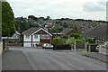
Colinwood Avenue
Looking across to the southern part of Rise Park.
Image: © Alan Murray-Rust
Taken: 20 Jul 2010
0.07 miles
2
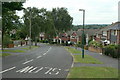
Brownlow Drive
This is the main distributor road in the northern section of Rise Park Estate. Looking west at Haverhill Crescent
Image: © Alan Murray-Rust
Taken: 20 Jul 2010
0.09 miles
3
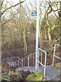
Little Oakwood Drive, Rise Park, Nottingham
A flight of steep steps that connect Little Oakwood Drive (off Brownlow Drive) with part of the former Leen Valley Railway track-bed. Houses on Bestwood Road are visible in the distance.
Image: © David Hallam-Jones
Taken: 24 Jan 2014
0.12 miles
4
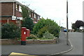
Haverhill Crescent postbox ref NG5 158
Standard EIIR pillar box with attached deliveries locker.
Image: © Alan Murray-Rust
Taken: 20 Jul 2010
0.13 miles
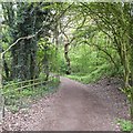
6
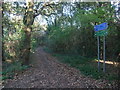
Cycle Route 6 leading towards Bestwood Park
Image: © Tim Heaton
Taken: 11 Nov 2012
0.15 miles
7
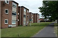
Oulton and Burnham Lodges
A small group of flat blocks in the Rise Park Estate.
Image: © Alan Murray-Rust
Taken: 20 Jul 2010
0.15 miles
8
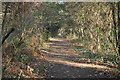
Route 6
NCN route 6 on the trackbed of the former Great Northern Leen Valley line
Image: © Richard Croft
Taken: 25 Nov 2011
0.16 miles
9
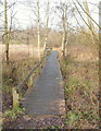
Moorbridge Pond Nature Reserve, Bestwood, Notts.
The stretch of raised boardwalk nearest to the reserve entrance on Bestwood Road (i.e. the B386 road). Moorbridge Pond and the nearby Springfield Corner were awarded Local Nature Reserve (LNR) status, as a joint site, in June 2012. Here the wooden walkway is seen heading towards the Moorbridge Caravan Site situated beyond the reserve's boundary fence.
Image: © David Hallam-Jones
Taken: 24 Jan 2014
0.16 miles
10
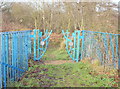
Bestwood Road, Nottingham
The ornate entrance into Moorbridge Nature Reserve from Bestwood Road (the B683). The Moorbridge Pond site, comprising over 2.5 hectares, is managed by the Nottingham Wildlife Trust under licence from Nottingham City Council. It is one of the very few wetland sites remaining within the city boundary. The pond is situated in the same location as the original "Bull Well", a freshwater spring, and is a remnant of a piece of wetland formerly known as Bulwell Bogs.
Image: © David Hallam-Jones
Taken: 24 Jan 2014
0.16 miles