
IMAGES TAKEN NEAR TO
Mapperley Street, NOTTINGHAM, NG5 4EJ
Introduction
This page details the photographs taken nearby to Mapperley Street, NG5 4EJ by members of the Geograph project.
The Geograph project started in 2005 with the aim of publishing, organising and preserving representative images for every square kilometre of Great Britain, Ireland and the Isle of Man.

There are currently over 7.5m images from over14,400 individuals and you can help contribute to the project by visiting https://www.geograph.org.uk
Image Map
Images are licensed for reuse under creativecommons.org/licenses/by-sa/2.0
Notes
- Clicking on the map will re-center to the selected point.
- The higher the marker number, the further away the image location is from the centre of the postcode.
Image Listing (123 Images Found)
Images are licensed for reuse under creativecommons.org/licenses/by-sa/2.0
Image
Details
Distance
1
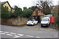
Garage of No.2 Mapperley Street on south side of the street
Ordnance Survey documents indicate that a benchmark levelled at 72.414m above Newlyn Datum on a wall in front of the garage was verified in 1962
Image: © Luke Shaw
Taken: 24 Apr 2020
0.02 miles
2
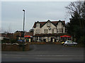
The Chestnut Tree
Pub/Restaurant on Mansfield Road, Sherwood. This was originally a large private house.
Image: © Alan Murray-Rust
Taken: 15 Mar 2009
0.03 miles
3
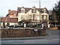
The Fat Cat
Formerly The Chestnut Tree.
Image: © Michael Dibb
Taken: 30 Mar 2017
0.04 miles
4
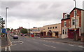
Sherwood, NG5, Nottingham
From the Burnham Street side of the road and looking along Mansfield Road (the A60) towards Sherwood's shopping centre, is an undertaker's establishment (with a pedestrian ramp and pitched porch) and beyond it is a rectangular 1950s/60s building that houses new Police Office or sub-station (as yet unopened) and the local library on the first floor.
Image: © David Hallam-Jones
Taken: 13 Jun 2013
0.04 miles
5
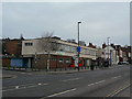
Sherwood Library
One of many suburban libraries in the City. The library occupies the upper floor, with some retail units underneath.
Image: © Alan Murray-Rust
Taken: 15 Mar 2009
0.04 miles
6
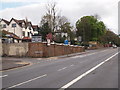
Nottingham - NG5
A view along a section of Mansfield Road, Sherwood looking in the city centre direction. This A60 road passes the newly redecorated "Chestnut Tree" pub (April 2012) here. The only chestnut tree growing in the vicinity nowadays is in the grounds of the adjacent dental practice. Beyond the traffic lights is a left-hand turning into Private Road.
Image: © David Hallam-Jones
Taken: 22 Apr 2012
0.04 miles
7
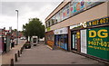
Sherwood, NG5, Nottingham.
On the right-hand side of Mansfield Road (the A60) the new - but as yet unopened -Police Office (or sub-station) is visible, together with the local library above it. Spondon Street branches off the A60, to the right, behind the tree.
Image: © David Hallam-Jones
Taken: 13 Jun 2013
0.05 miles
8
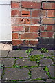
Benchmark on garage of No. 8 Private Road
Ordnance Survey cut mark benchmark described on the Bench Mark Database at www.bench-marks.org.uk/bm84936
Image: © Luke Shaw
Taken: 18 Apr 2020
0.05 miles
9
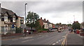
Sherwood NG5, Nottingham
Looking along the main road that passes through Sherwood (i.e. Mansfield Road, the A60) from junction with Burnham Street and towards the main shopping centre. The Sherwood Club, on the corner of Burnham Street, closed during the latter part of 2012. The Welbeck Medical Practice occupies the single storey brick building on the left, beyond the Sherwood Club. Opposite this GP surgery and behind the bus shelter is the new Police Office (sub-station) which, although now ready, remains to be put into use.
Image: © David Hallam-Jones
Taken: 13 Jun 2013
0.05 miles
10
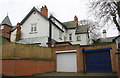
Garages of No. 8 Private Road
There is an Ordnance Survey cut mark benchmark Image in the bricks on the right hand side of the garage with the white door
Image: © Luke Shaw
Taken: 8 Mar 2019
0.05 miles