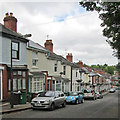
IMAGES TAKEN NEAR TO
Sherwood Avenue, NOTTINGHAM, NG5 4AN

Introduction

This page details the photographs taken nearby to Sherwood Avenue, NG5 4AN by members of the Geograph project.

The Geograph project started in 2005 with the aim of publishing, organising and preserving representative images for every square kilometre of Great Britain, Ireland and the Isle of Man.

There are currently over 7.5m images from over14,400 individuals and you can help contribute to the project by visiting https://www.geograph.org.uk

Image Map


Images are licensed for reuse under creativecommons.org/licenses/by-sa/2.0
Notes
  • Clicking on the map will re-center to the selected point.
  • The higher the marker number, the further away the image location is from the centre of the postcode.

Image Listing (99 Images Found)

Images are licensed for reuse under creativecommons.org/licenses/by-sa/2.0
  • ...
Image
Details
Distance
1
Cavendish Vale, Sherwood
Seen from Winchester Street, with Woodthorpe Court towering in the distance.
Image: © Richard Vince Taken: 14 Jul 2012
0.05 miles
2
Sherwood Vale
Late 19th/early 20th century housing in Sherwood to the east of Mansfield Road.
Image: © Alan Murray-Rust Taken: 8 Mar 2009
0.08 miles
3
Benchmark on No. 6 Winchester Street
Ordnance Survey cut mark benchmark described on the Bench Mark Database at www.bench-marks.org.uk/bm114812
Image: © Luke Shaw Taken: 1 Apr 2019
0.09 miles
4
Sherwood, NG5, Nottingham.
Hall Street from the intersection with Mansfield Street. Mansfield Road (the A60) lies behind 30 seconds walk away behind the photographer.
Image: © David Hallam-Jones Taken: 13 Jun 2013
0.09 miles
5
Sherwood: down Dornoch Avenue
One of the many steep streets on the hilly eastern side of the city.
Image: © John Sutton Taken: 17 Jun 2014
0.09 miles
6
Nos. 6 and 4 Winchester Street
There is an Ordnance Survey benchmark Image at the junction of the two houses
Image: © Luke Shaw Taken: 1 Apr 2019
0.10 miles
7
Nos. 110 and 108 Mansfield Street
Ordnance Survey records indicate that a benchmark levelled at 62.240m above Newlyn Datum was verified in 1962 on the near corner of the right hand house. However, the houses appear to have been rebuilt in 2015
Image: © Roger Templeman Taken: 8 May 2022
0.12 miles
8
Nottingham, NG5 - Sherwood
With the initial section of Elmswood Gardens and Mansfield Road (A60) both behind the photographer, this is a view of the middle section of Elmswood Gardens with Sherwood Health Centre on the left and the two tower blocks - "Woodthorpe Court" and "Winchester Court" situated on Chestnut Walk, in the distance.
Image: © David Hallam-Jones Taken: 24 Nov 2012
0.12 miles
9
Marshall Street, Sherwood
Image: © Oxymoron Taken: 17 Aug 2008
0.13 miles
10
Marshall Street
Part of the Victorian development of Sherwood off Mansfield Road.
Image: © Alan Murray-Rust Taken: 15 Mar 2009
0.14 miles
  • ...