1
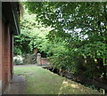
Valley Road Park
The western end of the wetlands section.
Image: © Alan Murray-Rust
Taken: 26 Jan 2022
0.04 miles
2
Day Brook Recreation Ground, Nottingham NG5
Midway between the bowling greens (behind the photographer) and where this footpath begins (or ends), near the junction of Valley Road with Mansfield Road, the footpath crosses the brook.
Image: © David Hallam-Jones
Taken: 12 Jul 2014
0.06 miles
3
Day Brook Recreation Ground, Nottingham NG5
With the eastern-most entrance/exit to the park near the junction of Mansfield Road and Valley Road no more than 5 minutes walk away behind the photographer, this is the view towards the midpoint of this long, thin (sausage-shaped) recreation ground. Several bowling greens lie 300-400 metres ahead on the other side of this cross-over point.
Image: © David Hallam-Jones
Taken: 12 Jul 2014
0.06 miles
4
Day Brook Recreation Ground, Nottingham NG5
With the eastern-most entrance/exit to the park near to the junction of Mansfield Road and Valley Road 5 minutes walk away behind the photographer this is the view towards the midpoint of this long, thin (sausage-shaped) recreation ground. Several bowling greens lie 300-400 metres ahead on the other side of this cross-over point.
Image: © David Hallam-Jones
Taken: 12 Jul 2014
0.06 miles
5
Day Brook Recreation Ground, Nottingham NG5
Here the brook passes beneath a footpath linking Mossdale Road and Valley Road (the A6514) at the side of a brick-built electricity substation.
Image: © David Hallam-Jones
Taken: 12 Jul 2014
0.06 miles
6
The Day Brook in Valley Road Park
This section was converted from grassland to a water meadow in around 2008 as a flood alleviation measure. Previously the brook ran in a narrow straight channel along the line of the hedge to the left. The structure in the foreground previously acted to reduce flow to some extent.
Image: © Alan Murray-Rust
Taken: 26 Jan 2022
0.06 miles
7
The Day Brook in Valley Road Park
A section of the brook which shows the constrained watercourse typical of the whole length of the section between Mansfield Road and its junction with the River Leen before the creation of flood alleviation measures in the Park in the early 21st century.
Image: © Alan Murray-Rust
Taken: 26 Jan 2022
0.06 miles
8
Day Brook Recreation Ground, Nottingham NG5
With Valley Road (the A6514) on the left, this picture shows the footpath descending towards the bowling greens and an intersecting footpath that links Valley Road and Mossdale Road. At this point the brook is running along the right-hand side of the photographer (off-screen).
Image: © David Hallam-Jones
Taken: 12 Jul 2014
0.06 miles
9
Day Brook Recreation Ground, Nottingham NG5
With the bowling greens and the electricity substation behind the photographer this is the view that walkers see as they walk towards the eastern entrance of the park near the Valley Road/Mansfield Road junction.
Image: © David Hallam-Jones
Taken: 12 Jul 2014
0.06 miles
10
Valley Road
Constructed as a dual carriageway ring road for the city in the 1930s. Today it is a designated trunk road.
Image: © Alan Murray-Rust
Taken: 8 Mar 2009
0.07 miles


