
IMAGES TAKEN NEAR TO
Ribblesdale Road, NOTTINGHAM, NG5 3GA
Introduction
This page details the photographs taken nearby to Ribblesdale Road, NG5 3GA by members of the Geograph project.
The Geograph project started in 2005 with the aim of publishing, organising and preserving representative images for every square kilometre of Great Britain, Ireland and the Isle of Man.

There are currently over 7.5m images from over14,400 individuals and you can help contribute to the project by visiting https://www.geograph.org.uk
Image Map
Images are licensed for reuse under creativecommons.org/licenses/by-sa/2.0
Notes
- Clicking on the map will re-center to the selected point.
- The higher the marker number, the further away the image location is from the centre of the postcode.
Image Listing (72 Images Found)
Images are licensed for reuse under creativecommons.org/licenses/by-sa/2.0
Image
Details
Distance
2
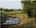
Valley Road Park, Nottingham NG5
The Day Brook is seen here entering the flood plain area of this precious green space. Behind the photographer's right shoulder is a man-made short cut out onto Mansfield Road (opposite Thackeray's Lane).
Image: © David Hallam-Jones
Taken: 12 Jul 2014
0.04 miles
3
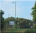
Valley Road Park, Nottingham, NG5
The main entrance/exit into and out of the eastern-most end of this park. Valley Road is on the other side of the fence.
Image: © David Hallam-Jones
Taken: 12 Jul 2014
0.05 miles
4
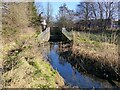
The Day Brook in Valley Road Park
The exit from the culvert under Mansfield Road. Originally running in a straight line, it was diverted to the right in around 2008 as part of flood alleviation measures.
Image: © Alan Murray-Rust
Taken: 26 Jan 2022
0.05 miles
5
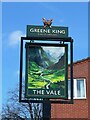
The sign of The Vale
Somewhat more idilic than its actual setting.
Fuller view of the pub: Image
Image: © David Lally
Taken: 2 Apr 2024
0.05 miles
6
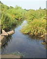
Valley Road Park, Nottingham NG5
The Day Brook, seen from the stepping stones near to the Valley Rd/Mansfield Rd park entrance, meanders through the flood plain area of this precious green space.
Image: © David Hallam-Jones
Taken: 12 Jul 2014
0.06 miles
7
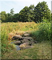
Valley Road Park Flood Plain, Nottingham NG5
These strategically placed boulders serve as stepping stones across Day Brook near to the park's Mansfield Rd/Valley Road junction entrance/exit.
Image: © David Hallam-Jones
Taken: 12 Jul 2014
0.06 miles
8
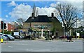
The Vale
Substantial public house from the 1930s.
One might assume as it is now a Greene King establishment that it was a Kimberly Ales (Hardy Hanson) tied house. However it was designed by T Cecil Howitt of Nottingham, for Home Ales Brewery. While it still sports the text-only sign on the substantial fluted column Image, it now also has a somewhat romantic vision of a mountain vale on a sign at the car park entrance on Mansfield Road Image
It has a Grade II listing List Entry Number:1255455 https://historicengland.org.uk/listing/the-list/list-entry/1255455?section=official-list-entry.
Image: © David Lally
Taken: 2 Apr 2024
0.06 miles

10
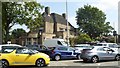
The Vale
Former Home Ales pub. Situated at a busy junction on the A60, as you can see.
The building is Grade II listed: List entry Number: 1255455 https://www.historicengland.org.uk/listing/the-list/list-entry/1255455
Image: © David Lally
Taken: 12 Jul 2018
0.06 miles