1
Nottingham - Sherwood NG5
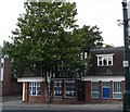
A view of Mansfield Rd (A60) looking in the direction of Nottingham city centre. The now defunct police station at No.621 Mansfield Road can be seen on the right, with the junction with Burlington Road beyond it. This station opened in October 2007 to provide a more visible local police presence. It was closed in 2011 as part of an economy drive although plans have been approved for the opening of a part-time mini-police station beneath Sherwood Library in 2012-13.
Image: © David Hallam-Jones
Taken: 16 Mar 2012
0.00 miles
2
Sherwood Police Station
Located in a building that looks more suitable for a bank than a cop shop..
Image: © Oxymoron
Taken: 17 Aug 2008
0.01 miles
3
Mansfield Road, Sherwood
The A60 in the Sherwood district of Nottingham.
Image: © David Dixon
Taken: 13 Oct 2022
0.01 miles
4
Sherwood Manor
Former Hardy Hanson's (Kimberley) pub on the corner of Mansfield Road and Edwards Lane. Now converted by Greene King to form part of their Hungry Horse chain.
Image: © David Lally
Taken: 30 Dec 2009
0.02 miles
5
Nottingham - Sherwood NG5
A view of "The Sherwood Manor" pub at the junction of Mansfield Rd (A60) and Edwards Lane. Formerly known as "The Garden City" public house.
Image: © David Hallam-Jones
Taken: 16 Mar 2012
0.02 miles
6
No. 664 Mansfield Road (Bargain Booze) at Hall Street junction
Ordnance Survey documents indicate that in 1962 a cut mark benchmark was levelled at 73.673m above Newlyn Datum on the building beside the Hall Street street name sign. The mark has been covered by render.
Image: © Luke Shaw
Taken: 1 Apr 2019
0.03 miles
7
Nottingham - Sherwood NG5
A view of the A60 in the Mansfield direction. The now defunct police station at No.621 Mansfield Road can be seen on the left at the junction with Burlington Road. This station opened in October 2007 to provide a more visible local police presence. It was closed in 2011 as part of a national economy drive, although plans have been approved for the opening of a part-time mini police station on the Sherwood library site in 2012-13.
Image: © David Hallam-Jones
Taken: 16 Mar 2012
0.03 miles
8
The Firs Home for the Elderly
Between 1941 and 1982 this was a maternity home. Today it is being completely renovated and extended and is a care home for the elderly.
Image: © Mick Garratt
Taken: 3 Dec 2005
0.04 miles
9
Nottingham - Sherwood NG5
A view of some of the "Sherwood shops" on Mansfield Rd (A60) looking in the direction of the Winchester St/Newstead St crossroads. A mini street market is held on this wider-than-average stretch of pavement once a month .
Image: © David Hallam-Jones
Taken: 16 Mar 2012
0.04 miles
10
Nottingham - NG5
A view of the junction of Edwards Lane, Sherwood at the point where it meets Mansfield Rd (A60). The Co-Op supermarket was previously a branch of Somerfield Stores Ltd. The Somerfield brand bought out the former Gateway supermarket chain in the 1990s but then the Somerfield chain was replaced by the Co-operative brand in a programme of store conversions that ended in Spring 2011. Behind the brick wall to the left are a range of retirement flats and bungalows on the site of the former Firs Maternity Hospital.
Image: © David Hallam-Jones
Taken: 21 Mar 2012
0.05 miles


