1
Nottingham High School Playing Field
This playing field, known as 'Valley Road', is a superb facility in all respects except that it is some two miles from the school itself. In this autumn term scene 17 years ago, groups of boys are being coached in the art of rugby football. It is a sobering thought that they will be aged around 30 now.
Image: © Stephen McKay
Taken: Unknown
0.15 miles
2
Hucknall Road Walkway marker ? rabbit
Alongside Hucknall Road at the southern end of the Walkway.
Image: © Alan Murray-Rust
Taken: 8 Feb 2022
0.16 miles
3
Fenton Road : railway remains
The trees to the right are growing on the remains of the Great Central Railway embankment. Beyond them, the embankment - 40ft high where the railway crossed Valley Road on its way south to Nottingham Victoria - has been levelled and the houses of Tunstall Drive built. Fenton Road follows the course of Bagthorpe East Curve, which brought trains from the Great Northern Derby Friargate line to join the GC at Bagthorpe Junction (which was just north of Valley Road bridge, way above the roofs of the present houses, and those on Harmston Rise and Heatherley Avenue, whose alignments follow the bottom of the former embankment). In railway days the downward slope straight ahead was a single railway line rising to meet the main line. To the right of the houses in the distance on the left of the picture, the railway passed through the cutting in the sandstone ridge shown in my
Image
Image: © John Sutton
Taken: 21 Jun 2011
0.16 miles
4
Hucknall Road Walkway markers
Alongside Hucknall Road at the southern end of the Walkway.
Image: © Alan Murray-Rust
Taken: 8 Feb 2022
0.16 miles
5
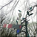
Signal sculpture with birds, Hucknall Road Walkway
Combining the main features of the walkway – former railway line, and nature reserve.
Image: © Alan Murray-Rust
Taken: 8 Feb 2022
0.17 miles
6
Nottingham High School Pavilion
On the School's playing fields alongside Valley Road
Image: © Alan Murray-Rust
Taken: 15 Mar 2009
0.17 miles
7
Foot- and cycleway improvement.
Part of the development of a linear walkway along the old GNR Leen Valley railway.
Image: © Alan Murray-Rust
Taken: 15 Mar 2009
0.17 miles
8
The southern entrance to Hucknall Road Walkway
The signal represents the fact that the walkway follows a former railway line.
Image: © Alan Murray-Rust
Taken: 8 Feb 2022
0.17 miles
9
Roadside railings, Hucknall Road
Installed as part of the Hucknall Road Walkway which runs in the background. It has various wildlife and associated motifs.
Image: © Alan Murray-Rust
Taken: 8 Feb 2022
0.17 miles
10
Tunstall Drive: once a railway embankment
Tunstall Drive is built where the Great Central Railway main line from Nottingham Victoria to Sheffield and Manchester once ran - on the top of an embankment in the region of 40ft above the present road level. The trees in the background grow on the slope of the truncated embankment and give an idea of how wide the earthworks were. Bagthorpe Junction and its signal box once stood roughly where I stood to take this picture, but a long way above my head. The scene at the top of what remains of the embankment is shown in
Image], and for more about the railway network in these parts, see
Image],
Image],
Image] and others.
Image: © John Sutton
Taken: 21 Jun 2011
0.18 miles


