Fenton Road : railway remains
Introduction
The photograph on this page of Fenton Road : railway remains by John Sutton as part of the Geograph project.
The Geograph project started in 2005 with the aim of publishing, organising and preserving representative images for every square kilometre of Great Britain, Ireland and the Isle of Man.

There are currently over 7.5m images from over 14,400 individuals and you can help contribute to the project by visiting https://www.geograph.org.uk
Fenton Road : railway remains
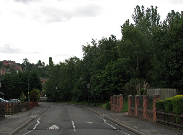
Image: © John Sutton Taken: 21 Jun 2011
The trees to the right are growing on the remains of the Great Central Railway embankment. Beyond them, the embankment - 40ft high where the railway crossed Valley Road on its way south to Nottingham Victoria - has been levelled and the houses of Tunstall Drive built. Fenton Road follows the course of Bagthorpe East Curve, which brought trains from the Great Northern Derby Friargate line to join the GC at Bagthorpe Junction (which was just north of Valley Road bridge, way above the roofs of the present houses, and those on Harmston Rise and Heatherley Avenue, whose alignments follow the bottom of the former embankment). In railway days the downward slope straight ahead was a single railway line rising to meet the main line. To the right of the houses in the distance on the left of the picture, the railway passed through the cutting in the sandstone ridge shown in my Image
Images are licensed for reuse under creativecommons.org/licenses/by-sa/2.0
Image Location
Latitude
52.987298
Longitude
-1.171435