
IMAGES TAKEN NEAR TO
Camelot Avenue, NOTTINGHAM, NG5 1DW
Introduction
This page details the photographs taken nearby to Camelot Avenue, NG5 1DW by members of the Geograph project.
The Geograph project started in 2005 with the aim of publishing, organising and preserving representative images for every square kilometre of Great Britain, Ireland and the Isle of Man.

There are currently over 7.5m images from over14,400 individuals and you can help contribute to the project by visiting https://www.geograph.org.uk
Image Map
Images are licensed for reuse under creativecommons.org/licenses/by-sa/2.0
Notes
- Clicking on the map will re-center to the selected point.
- The higher the marker number, the further away the image location is from the centre of the postcode.
Image Listing (75 Images Found)
Images are licensed for reuse under creativecommons.org/licenses/by-sa/2.0
Image
Details
Distance
1
Linette Close, New Basford
Linette Close is a tiny offshoot of Camelot Avenue (see Image), and is just about large enough to warrant its own turning area.
Image: © Richard Vince
Taken: 9 Jun 2012
0.02 miles
2
Camelot Avenue, New Basford
Looking south along Camelot Avenue, which was built on part of the site of New Basford railway station after the demolition of the embankment that carried the railway at this point.
Image: © Richard Vince
Taken: 9 Jun 2012
0.03 miles
4
Turning area, Camelot Avenue
The turning facility at the south end of Camelot Avenue, New Basford. The road ends just beyond the further of the two parked cars.
Image: © Richard Vince
Taken: 9 Jun 2012
0.08 miles
5
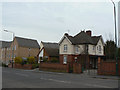
Station House, Haydn Road
This was presumably the station master's house for Basford Station, which occupied the site where the new housing can be seen behind the older house. That area was once Basford Station on the old Great Central Railway main line. This crossed the road by a girder bridge, of which the only trace is a dip in the road created to provide headroom under it.
Image: © Alan Murray-Rust
Taken: 15 Mar 2009
0.08 miles
6
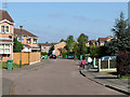
Camelot Avenue, New Basford
It is hard to believe there was once a main line railway here. Camelot Avenue is built on the site of the passenger and goods stations at New Basford. The goods sidings were to the left and the island-platform passenger station straight ahead.
The Great Central Railway main line from London Marylebone to Sheffield via Leicester and Nottingham was the last trunk route to be completed (1899) and the first to close (1967). North of Nottingham and in the city much of its route has disappeared - embankments flattened, cuttings filled, viaducts demolished - and it is hard to follow. After passing through the 665-yard Sherwood Rise Tunnel northbound trains entered a deep cutting in the sandstone (behind the camera). The cutting has now been filled in - see Image
Image: © John Sutton
Taken: 28 Apr 2011
0.09 miles
7
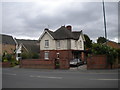
Station House, Haydn Road, New Basford
Although New Basford railway station and the embankment that carried it are long gone, the Station House still stands on Haydn Road.
Image: © Richard Vince
Taken: 9 Jun 2012
0.09 miles
8
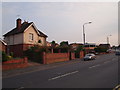
Nottingham - NG5 (Basford)
A former railway building on Haydn Rd, almost (but not quite) at the junction with Camelot Avenue, New Basford. This property, now known as Station House, was previously situated at the approach to New Basford station. The station was one on the Great Central Railway main line. It was opened when the line did in 1899 and was also used by trains to/from Ilkeston, Derby, Uttoxeter & Stafford on the Derbyshire and Staffordshire extension of the Great Northern Railway. The station itself (i.e. not this building) was of the "island" type with a central 'pad' with its platforms situated between the up and down lines. In this case however, the station was also raised up on an embankment and therefore the platforms had to be accessed from Haydn Road via an ancillary passageway/roadway that passed beneath the lines. This section of the line closed completely on 25 March 1968.
Image: © David Hallam-Jones
Taken: 23 May 2012
0.09 miles

10
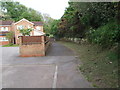
Nottingham - NG5 (Basford)
The footpath that commences at the end of this cul-de-sac (Camelot Avenue) leads to a sandstone cutting that previously carried the Great Central Railway main line towards New Basford station. The station was situated half a mile or so behind the photographer, off Haydn Road. The railway line, having come out of the Sherwood Rise tunnel, used to run to the left of these houses. The station itself (no longer in existence) was of the "island" type with the central ‘pad’ and its platforms located between the up and the down tracks. In this case however, the former station was apparently situated on a raised embankment, meaning that the station was accessed from a subterranean roadway or passageway off Haydn Road that passed beneath the lines. This section of the line closed completely on 25 March 1968
Image: © David Hallam-Jones
Taken: 23 May 2012
0.10 miles