Nottingham - NG5 (Basford)
Introduction
The photograph on this page of Nottingham - NG5 (Basford) by David Hallam-Jones as part of the Geograph project.
The Geograph project started in 2005 with the aim of publishing, organising and preserving representative images for every square kilometre of Great Britain, Ireland and the Isle of Man.

There are currently over 7.5m images from over 14,400 individuals and you can help contribute to the project by visiting https://www.geograph.org.uk
Nottingham - NG5 (Basford)
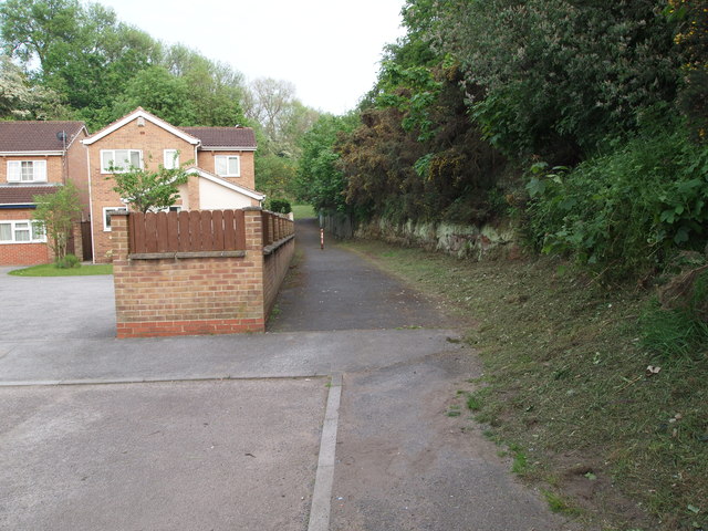
Image: © David Hallam-Jones Taken: 23 May 2012
The footpath that commences at the end of this cul-de-sac (Camelot Avenue) leads to a sandstone cutting that previously carried the Great Central Railway main line towards New Basford station. The station was situated half a mile or so behind the photographer, off Haydn Road. The railway line, having come out of the Sherwood Rise tunnel, used to run to the left of these houses. The station itself (no longer in existence) was of the "island" type with the central ‘pad’ and its platforms located between the up and the down tracks. In this case however, the former station was apparently situated on a raised embankment, meaning that the station was accessed from a subterranean roadway or passageway off Haydn Road that passed beneath the lines. This section of the line closed completely on 25 March 1968
Images are licensed for reuse under creativecommons.org/licenses/by-sa/2.0
Image Location
Latitude
52.975814
Longitude
-1.161825