IMAGES TAKEN NEAR TO
Bentinck Road, NOTTINGHAM, NG4 3QD
Introduction
This page details the photographs taken nearby to Bentinck Road, NG4 3QD by members of the Geograph project.
The Geograph project started in 2005 with the aim of publishing, organising and preserving representative images for every square kilometre of Great Britain, Ireland and the Isle of Man.

There are currently over 7.5m images from over14,400 individuals and you can help contribute to the project by visiting https://www.geograph.org.uk
Image Map
Images are licensed for reuse under creativecommons.org/licenses/by-sa/2.0
Notes
- Clicking on the map will re-center to the selected point.
- The higher the marker number, the further away the image location is from the centre of the postcode.
Image Listing (25 Images Found)
Images are licensed for reuse under creativecommons.org/licenses/by-sa/2.0
Image
Details
Distance
2
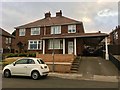
A somewhat pretentious car port
Marwood Road
Image: © David Lally
Taken: 6 Jul 2018
0.04 miles
3
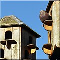
Enjoying the sunshine
Pigeon cotes on Portland Road.
Image: © Alan Murray-Rust
Taken: 12 Jan 2021
0.10 miles
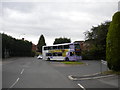
4
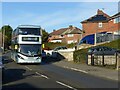
27 bus to City
On the upper part of Coningswath Road.
Image: © Alan Murray-Rust
Taken: 12 Jan 2021
0.13 miles
5
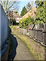
Local twitchell
Between Portland Road and Cavendish Road top.
Image: © Alan Murray-Rust
Taken: 12 Jan 2021
0.13 miles
6
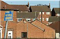
Carlton roofscape ? 3
No ball games.
Image: © Alan Murray-Rust
Taken: 12 Jan 2021
0.13 miles
7
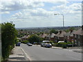
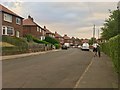
Top of Cavendish Road
Taken specifically for comparison with the image in Domesday Reloaded http://www.bbc.co.uk/history/domesday/dblock/GB-460000-339000/picture/3 .
The picture gives an excellent idea of the scenery of the D-block to which it is assigned, but in fact is located in the next D-block north.
As a local resident, the location was immediately familiar. The view is virtually unchanged exact for a bit more green growth and one re-sited street lamp.
Image: © Alan Murray-Rust
Taken: 24 May 2011
0.15 miles
8
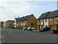
Housing on Cavendish Road
Developed around 2015 on the site of The Cavendish public house which had closed around 2010 https://www.geograph.org.uk/photo/2427869
Image: © Alan Murray-Rust
Taken: 27 May 2021
0.15 miles
9
Elmhurst Avenue terminus, Carlton
A 27 from Nottingham city centre using the turning circle to reach the bus stop (next to the enormous hedge on the left) and face the right way to return to the city.
Image: © Richard Vince
Taken: 25 Jun 2011
0.15 miles
10
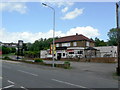
The Cavendish, Cavendish Road, Carlton
The Hand Car Wash sign conceals the 'To Let' sign on the front of this pub, which appears to be yet another suburban road-house-style-pub casualty.
Image: © Alan Murray-Rust
Taken: 24 May 2011
0.15 miles