1
Houses, Greenwood Rd
Image: © N Chadwick
Taken: 29 Oct 2014
0.05 miles
2
Footbridge at Carlton
This footbridge crosses the rail-line at Carlton, on the edge of Colwick Woods.
Image: © Donnylad
Taken: 2 Jun 2007
0.05 miles
3
Lawrence Avenue, Colwick.
The Lawrence furniture factory was a major landmark in the area, now replaced by this housing development; the name lives on.
Image: © Alan Murray-Rust
Taken: 14 Jan 2007
0.05 miles
4
Tin Bridge, Colwick
The Tin Bridge, as it is colloquially known, crosses the former Midland Railway line east from Nottingham, providing a pedestrian link between Colwick and Bakersfield. The steps at either end of the bridge have been fitted with very narrow chutes to enable bicycles to be wheeled rather than carried.
Image: © Richard Vince
Taken: 13 Apr 2013
0.05 miles
5
Colwick Vale sewage pumping station
A very necessary feature of the flat alluvial lands close to the River Trent, with the main treatment works at a higher level than the sewers.
Image: © Alan Murray-Rust
Taken: 25 Dec 2020
0.08 miles
6
Modern housing on Vale Road
Late 20th century housing on a former industrial site.
Image: © Alan Murray-Rust
Taken: 25 Dec 2020
0.08 miles
7
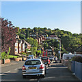
East end of Greenwood Road, Bakersfield
The bus stop on the right is the nominal terminus for Nottingham City Transport route 43, though buses seldom wait there as they serve Bakersfield with a unidirectional loop.
Image: © Richard Vince
Taken: 13 Apr 2013
0.08 miles
8
Bakersfield: the eastern end of Greenwood Road
The 43 bus is about to turn left into Douglas Avenue and climb to Oakdale Road.
Image: © John Sutton
Taken: 23 Sep 2015
0.09 miles
9
Housing on Vale Road, Colwick
Image: © Richard Vince
Taken: 13 Apr 2013
0.09 miles
10
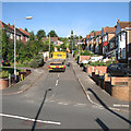
Bakersfield: a delivery at Greenwood Crescent
One of many steep suburban streets on the hilly eastern side of Nottingham.
Image: © John Sutton
Taken: 23 Sep 2015
0.09 miles


