
IMAGES TAKEN NEAR TO
Kirkdale Road, NOTTINGHAM, NG3 7GY
Introduction
This page details the photographs taken nearby to Kirkdale Road, NG3 7GY by members of the Geograph project.
The Geograph project started in 2005 with the aim of publishing, organising and preserving representative images for every square kilometre of Great Britain, Ireland and the Isle of Man.

There are currently over 7.5m images from over14,400 individuals and you can help contribute to the project by visiting https://www.geograph.org.uk
Image Map
Images are licensed for reuse under creativecommons.org/licenses/by-sa/2.0
Notes
- Clicking on the map will re-center to the selected point.
- The higher the marker number, the further away the image location is from the centre of the postcode.
Image Listing (47 Images Found)
Images are licensed for reuse under creativecommons.org/licenses/by-sa/2.0
Image
Details
Distance
1
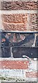
Benchmark on Post Office at #74 Oakwood Road
Ordnance Survey cut mark benchmark levelled at 71.604m above Newlyn Datum verified 1962
Image: © Roger Templeman
Taken: 26 Sep 2022
0.04 miles
2
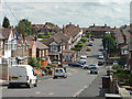
Eastdale Road
Looking across Oakdale Road and up to Harrogate Road. At this point the private housing development changes to a council estate.
Image: © Alan Murray-Rust
Taken: 20 Jun 2008
0.05 miles
3
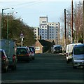
The view along Hereford Road
The long-empty Windmill Lane tower block https://www.geograph.org.uk/photo/822346 looks very truncated from this viewpoint.
Image: © Alan Murray-Rust
Taken: 26 Dec 2017
0.10 miles
4
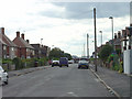
Langdale Road looking west
This is the last of the 'dales', and marks the change from private to council development. Interestingly the council development has longer front gardens than the private!
Image: © Alan Murray-Rust
Taken: 20 Jun 2008
0.11 miles
5
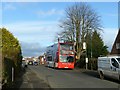
Boxing Day bus
Nottingham City Transport was running a skeleton service on principal routes only, but it's more than many towns would 'enjoy'.
Image: © Alan Murray-Rust
Taken: 26 Dec 2017
0.11 miles
6
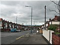
Bakersfield: Oakdale Road
Oakdale Road is an extension of Sneinton Dale, developed in the 1930s as the city expanded eastwards. This is the view down the hill towards the city centre.
Image: © John Sutton
Taken: 10 May 2012
0.11 miles
7
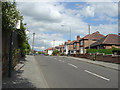
Parkdale Road looking north-east
Most of the roads in this area are 'dales'
Image: © Alan Murray-Rust
Taken: 20 Jun 2008
0.12 miles
8
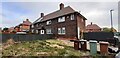
Ripon Road houses at Ashworth Close junction
There is an Ordnance Survey benchmark Image on the near corner, left hand face, of the nearest house
Image: © Roger Templeman
Taken: 26 Sep 2022
0.14 miles
9

Benchmark on #26 Ripon Road
Ordnance Survey cut mark benchmark levelled at 79.989m above Newlyn Datum verified 1962
Image: © Roger Templeman
Taken: 26 Sep 2022
0.14 miles
10
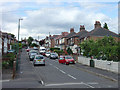
Rosedale Road
Looking up from Oakdale Road to Parkdale Road. Most of the local road names end in -dale.
Image: © Alan Murray-Rust
Taken: 20 Jun 2008
0.15 miles