1
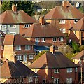
Nottingham roofscape
Classic Nottingham City Council council houses of the inter-war period, with hipped roofs and central chimney stack.
Image: © Alan Murray-Rust
Taken: 25 Dec 2020
0.04 miles
2
Sneinton Dale: Ipswich Circus
Nottingham built council houses in Garden City style all over the city.
Image: © John Sutton
Taken: 4 Jul 2016
0.05 miles
3
#337 Sneinton Dale at Hemswell Close junction
Ordnance Survey documents indicate that a benchmark levelled at 49.743m above Newlyn Datum was verified in 1962 on the west angle of the house
Image: © Roger Templeman
Taken: 26 Sep 2022
0.08 miles
4
Redundant rail tunnel entrance
Apparently the line ran through a station just the other side of Carlton Road
Image: © David Lally
Taken: 13 Jul 2018
0.09 miles
5
Sneinton Dale: up Skipton Circus
Nottingham built council houses in Garden City style all over the city. The right-hand street name is the cream-painted cast-iron circle once universal in the city's estates, but the one on the left is a modern replacement. The picture gives some idea of the hilliness of the eastern suburbs.
Image: © John Sutton
Taken: 4 Jul 2016
0.10 miles
6
Sneinton Cliffs
The result of clay quarrying for the formerly extensive brick manufacturing industry in East Nottingham
Image: © Alan Murray-Rust
Taken: 21 Jan 2007
0.11 miles
7
A path into the bushes
But what is its purpose?
Image: © Alan Murray-Rust
Taken: 27 May 2021
0.11 miles
8
Site of demolished house of Sneinton Farm on NW side of Sneinton Dale
Ordnance Survey documents indicate that a benchmark levelled at 41.883m above Newlyn Datum was verified in 1962 on the house
Image: © Roger Templeman
Taken: 26 Sep 2022
0.17 miles
9
Roundabout in Bakersfield
This roundabout, at the east end of Sneinton Dale, was once used to turn buses on Nottingham City Transport route 34, a shortworking of the Bakersfield service that, latterly at least, operated only as and when required. The housing visible here is typical 1930s Nottingham council housing. From the left, the roads are Sneinton Dale, Linton Rise, Cardale Road, and (just visible in the foreground) Oakdale Road. Watson Avenue is just out of frame to the right.
Image: © Richard Vince
Taken: 13 Apr 2013
0.20 miles
10
Five Ways Island
Recreating this 'First' for the square https://www.geograph.org.uk/photo/43308 . There has been virtually no subsequent change other than the removal of one of the large trees to the right of the picture.
Image: © Alan Murray-Rust
Taken: 23 May 2021
0.20 miles


