Sneinton Dale: up Skipton Circus
Introduction
The photograph on this page of Sneinton Dale: up Skipton Circus by John Sutton as part of the Geograph project.
The Geograph project started in 2005 with the aim of publishing, organising and preserving representative images for every square kilometre of Great Britain, Ireland and the Isle of Man.

There are currently over 7.5m images from over 14,400 individuals and you can help contribute to the project by visiting https://www.geograph.org.uk
Sneinton Dale: up Skipton Circus
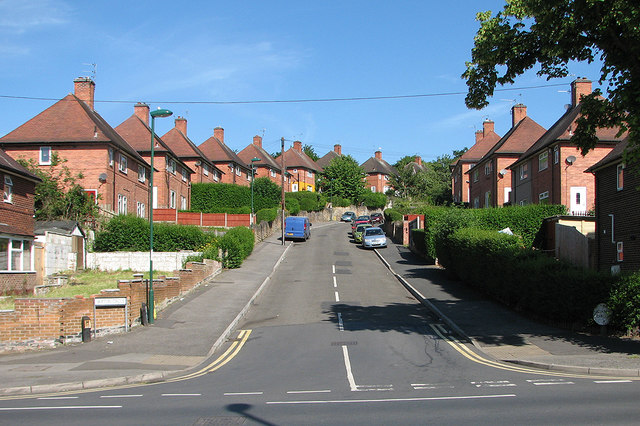
Image: © John Sutton Taken: 4 Jul 2016
Nottingham built council houses in Garden City style all over the city. The right-hand street name is the cream-painted cast-iron circle once universal in the city's estates, but the one on the left is a modern replacement. The picture gives some idea of the hilliness of the eastern suburbs.
Images are licensed for reuse under creativecommons.org/licenses/by-sa/2.0
Image Location
Latitude
52.956538
Longitude
-1.119178