IMAGES TAKEN NEAR TO
Blyth Street, NOTTINGHAM, NG3 5JF

Introduction

This page details the photographs taken nearby to Blyth Street, NG3 5JF by members of the Geograph project.

The Geograph project started in 2005 with the aim of publishing, organising and preserving representative images for every square kilometre of Great Britain, Ireland and the Isle of Man.

There are currently over 7.5m images from over14,400 individuals and you can help contribute to the project by visiting https://www.geograph.org.uk

Image Map


Images are licensed for reuse under creativecommons.org/licenses/by-sa/2.0
Notes
  • Clicking on the map will re-center to the selected point.
  • The higher the marker number, the further away the image location is from the centre of the postcode.

Image Listing (58 Images Found)

Images are licensed for reuse under creativecommons.org/licenses/by-sa/2.0
  • ...
Image
Details
Distance
1
Transmission mast, Mapperley
There are a number of masts on the high ground of the Mapperley area as the location gives good local coverage not only of the whole city area but also for longer distances.
Image: © Alan Murray-Rust Taken: 27 Nov 2022
0.02 miles
2
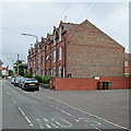
Blyth Street, Mapperley
The road layout here was clearly established at the end of the 19th century, but development was apparently slow and piecemeal, as there are a variety of housing styles.
Image: © Alan Murray-Rust Taken: 8 Mar 2009
0.06 miles
3
Elliot Durham baths
Part of the Elliot Durham School Campus. The roadway to the left is the main access to the school.
Image: © Alan Murray-Rust Taken: 8 Mar 2009
0.06 miles
4
Wintry shower
View from the top of Ransom Road over to Ratcliffe on Soar Power Station Image
Image: © Alan Murray-Rust Taken: 8 Mar 2009
0.07 miles
5
Ransom Road, upper part
Connecting the high ridge, carrying Woodborough Road, with the St Ann's valley.
Image: © Alan Murray-Rust Taken: 27 Nov 2022
0.08 miles
6
Mapperley: Horology Terrace, Ransom Road
A terrace with an intriguing name at the Woodborough Road end of Ransom Road. It was built in 1894, as Image] shows. Rob Noble has offered a possible explanation for the name: "The initials are suggestive of Francis Frederick Cope (1845-1901) of the Nottingham clockmaking firm G & F Cope. I'm not sure why this terrace is in Mapperley when the family was based in the Radford area, but I suppose as a successful businessman it is possible he would have invested his money in property across the city."
Image: © John Sutton Taken: 15 Jun 2014
0.08 miles
7
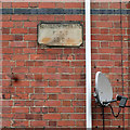
Mapperley: Horology Terrace - date stone and dish
A terrace with an interesting name at the Woodborough Road end of Ransom Road. For the wider context, see Image Rob Noble has offered a possible explanation for the name: "The initials are suggestive of Francis Frederick Cope (1845-1901) of the Nottingham clockmaking firm G & F Cope. I'm not sure why this terrace is in Mapperley when the family was based in the Radford area, but I suppose as a successful businessman it is possible he would have invested his money in property across the city."
Image: © John Sutton Taken: 15 Jun 2014
0.09 miles
8
Top of Ransom Road
The high ground to the north east of Nottingham City Centre provides fine views over the Trent Valley and beyond - even when the weather is not at its best.
Image: © Alan Murray-Rust Taken: 8 Mar 2009
0.10 miles
9
Ransom Drive
Recent housing (2017-18) on the site of the former Springwood Centre https://www.geograph.org.uk/photo/1197640 https://www.geograph.org.uk/photo/1197610 .
Image: © Alan Murray-Rust Taken: 27 Nov 2022
0.10 miles
10
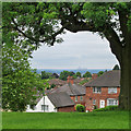
Mapperley Top to Ratcliffe-on-Soar
A view from Ransom Road, near the top of the Mapperley ridge, with the chimney and cooling towers of Ratcliffe-on-Soar power station in the distance. The spot height nearby is 112m/368ft, so there are long views over the Trent Valley to the south-west and to the Vale of Belvoir to the south-east. For comparison, see Alan Murray-Rust's Image], taken with a more powerful zoom lens.
Image: © John Sutton Taken: 15 Jun 2014
0.10 miles
  • ...