1
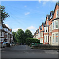
Mapperley Park Drive
Grand terraces line a road linking Magdala Road and Redcliffe Road (ahead).
Image: © John Sutton
Taken: 17 Jun 2014
0.01 miles
2
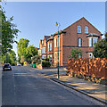
Magdala Road, Mapperley Park
Image: © Chris Whippet
Taken: 28 Jul 2015
0.03 miles
3
Zulla Road, Mapperley Park
Image: © Chris Whippet
Taken: 28 Jul 2015
0.05 miles
4
Nottingham, NG3 - Mapperley Park
Looking along Redcliffe Road in the direction of Mansfield Road (the A60) from Mapperley Road that lies behind the photographer. Red Lane, as it was known until c.1870, was apparently "inaccessible during the winter months". Heavy brick-laden carts descending from Mapperley's brickworks would no doubt have contributed to the damage to this unmade road. On the left is the former coach house of Claremont House situated on neighbouring Elm Bank. The coach house is now a separate property that has been converted into a private house known as "Claremont Stables".
Image: © David Hallam-Jones
Taken: 4 Nov 2012
0.06 miles
5
Claremont Stables, Redcliffe Road
Purpose-built stables and coach-house for a large house called Claremont.http://www.geograph.org.uk/photo/3210559
Image: © Alan Murray-Rust
Taken: 18 Mar 2014
0.06 miles
6
Up Zulla Road
Looking north from near the junction with Redcliffe Road on a clear May evening.
Image: © John Sutton
Taken: 20 May 2023
0.06 miles
7
Nottingham, NG3 - Mapperley Park
Looking up Elm Bank from Redcliffe Road. Red Lane, as it was known until c.1870, was apparently "inaccessible during the winter months". Therefore, this link with Mapperley Road - if it existed in the 19th century - would have been impossible to ascend. The gates on the right open into the stable block forecourt of Claremont House, the large bay-windowed property.
Image: © David Hallam-Jones
Taken: 4 Nov 2012
0.06 miles
8
Junction of Redcliffe Road and Zulla Road
Redcliffe Road (centre) is one of the more significant roads through Mapperley Park, while Zulla Road (left foreground) parallels Mansfield Road for about a quarter of a mile, passing the backs of a few hotels.
Image: © Richard Vince
Taken: 12 Apr 2010
0.07 miles
9
Up Redcliffe Road
Redcliffe Road leads uphill through the southern end of Mapperley Park from Mansfield Road to Woodborough Road (ahead). Zulla Road is to the left and Thorncliffe Road to the right in this picture taken on a cloudless May evening.
Image: © John Sutton
Taken: 20 May 2023
0.07 miles
10
View north along Zulla Road
Taken from just north of the junction with Magdala Road. The junction with Shirley Road is just beyond the very pink, very blossom laden tree on the right.
Image: © Richard Vince
Taken: 12 Apr 2010
0.07 miles


