Nottingham, NG3 - Mapperley Park
Introduction
The photograph on this page of Nottingham, NG3 - Mapperley Park by David Hallam-Jones as part of the Geograph project.
The Geograph project started in 2005 with the aim of publishing, organising and preserving representative images for every square kilometre of Great Britain, Ireland and the Isle of Man.

There are currently over 7.5m images from over 14,400 individuals and you can help contribute to the project by visiting https://www.geograph.org.uk
Nottingham, NG3 - Mapperley Park
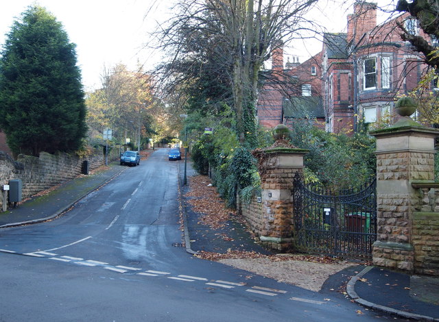
Image: © David Hallam-Jones Taken: 4 Nov 2012
Looking up Elm Bank from Redcliffe Road. Red Lane, as it was known until c.1870, was apparently "inaccessible during the winter months". Therefore, this link with Mapperley Road - if it existed in the 19th century - would have been impossible to ascend. The gates on the right open into the stable block forecourt of Claremont House, the large bay-windowed property.
Images are licensed for reuse under creativecommons.org/licenses/by-sa/2.0
Image Location
Latitude
52.969528
Longitude
-1.150034