IMAGES TAKEN NEAR TO
St. Andrews Road, NOTTINGHAM, NG3 5BP

Introduction

This page details the photographs taken nearby to St. Andrews Road, NG3 5BP by members of the Geograph project.

The Geograph project started in 2005 with the aim of publishing, organising and preserving representative images for every square kilometre of Great Britain, Ireland and the Isle of Man.

There are currently over 7.5m images from over14,400 individuals and you can help contribute to the project by visiting https://www.geograph.org.uk

Image Map


Images are licensed for reuse under creativecommons.org/licenses/by-sa/2.0
Notes
  • Clicking on the map will re-center to the selected point.
  • The higher the marker number, the further away the image location is from the centre of the postcode.

Image Listing (306 Images Found)

Images are licensed for reuse under creativecommons.org/licenses/by-sa/2.0
  • ...
Image
Details
Distance
1
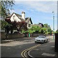
Mapperley Park: St Andrew's Road
Edwardian and more modern houses on the southern edge of Mapperley Park.
Image: © John Sutton Taken: 6 Jul 2015
0.02 miles
2
St. Andrew's Road, Mapperley Park
Image: © Chris Whippet Taken: 28 Jul 2015
0.02 miles
3
Wyndham Mews
Off St Andrew's Road, on the edge of Mapperley Park. St Andrew's Church spire shows on the skyline
Image: © John Sutton Taken: 6 Jul 2015
0.04 miles
4
Mapperley Park: an Edwardian house on Thorncliffe Road
Dated 1903.
Image: © John Sutton Taken: 6 Jul 2015
0.04 miles
5
Mansfield Court
Art deco style flats on Mansfield Road near The Forest.
Image: © Alan Murray-Rust Taken: 15 Mar 2009
0.04 miles
6
Pollution monitoring
This equipment for monitoring pollution is at the corner of Mansfield Road and St Andrews Road.
Image: © Michael Dibb Taken: 31 Mar 2017
0.04 miles
7
Mapperley Park: St Andrew's Road to Chestnut Grove
David Hallam-Jones's Image] shows the top end of this leafy twitchel.
Image: © John Sutton Taken: 6 Jul 2015
0.05 miles
8
Nottingham, NG3 - Former Forest House
A view along the drive that forms an arc around the front of the former Nottingham Children's Hospital (c.1905-1980), as seen from a former lodge house situated at the Chestnut Grove entry to the site. The gate posts on the left bear the words "Children's" and "Hospital" but the fact that the space between them would permit nothing larger than a medium size dog to pass through them and the fact that there is nothing at all of note beyond them seems to suggest that they have simply been placed there as reminders of the past.
Image: © David Hallam-Jones Taken: 3 Nov 2012
0.05 miles
9
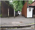
Nottingham - NG3
This sloping alleyway links St Andrew's Road (in the distance) with the closed end of the Chestnut Grove cul-de-sac. As a result, residents living in the Robert Wilkinson Smith Homes would see this passageway straight ahead once having passed through the entrance gate that serves their residential complex. Mansfield Road is 2-3 minutes walk from the lower end of this path.
Image: © David Hallam-Jones Taken: 17 Jun 2012
0.05 miles
10
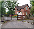
Nottingham - NG3
Chestnut Grove is now a cul-de-sac created by these gates, whereas the drive beyond the gates actually links to Berkeley Avenue. These gates act to secure one of the entrances/exits to Forest House, a property-with-grounds that has served several masters in the past. The domestic-sized house behind the gates may have been a gate lodge and a porter's lodge in the past. The extensive premises themselves (not visible here) were once the home of Thomas Isaac Birkin, of the lace making dynasty. When he became the 1st Baronet of Ruddington Grange and moved to Ruddington he gave the property away for conversion into a Children's Hospital. It functioned as such (with extensions) until the early 1980s when it became the HQ of Nottinghamshire Area Health Authority and later on the base of Nottingham Health Authority.
Image: © David Hallam-Jones Taken: 17 Jun 2012
0.06 miles
  • ...