1
Abbotsford Drive
Looking towards the City Centre, with the Victoria Centre flats on the skyline. This road was created from scratch as part of the St Anns redevelopment of the 1970s and is a main feeder road for the area.
Image: © Alan Murray-Rust
Taken: 8 Mar 2009
0.09 miles
2
St Augustine of England Catholic church
Image: © JThomas
Taken: 1 Jul 2010
0.10 miles
3
Woodborough Road: St Augustine of England RC Church
Like a Romanesque fortress, with shallow Byzantine domes only just visible from this angle.
Image: © John Sutton
Taken: 1 Jul 2015
0.10 miles
4
St Augustine's Church, Woodborough Road - north-east end
This is presumably the liturgical west end, with its central door. This Roman Catholic church was built in 1920-23, architect John Sidney Brocklesby, and was listed grade II in 2012 as "an accomplished architectural design that combines modern and traditional materials and construction techniques to interpret traditional forms in a sophisticated and highly individual manner" (list entry 1406263).
Image: © Stephen Craven
Taken: 18 Jan 2020
0.10 miles
5
St Augustine's Church, Woodborough Road - west side
This is presumably the liturgical south side, with the chancel to the right supporting a "dome made of Snowcrete" (a form of cement render). This Roman Catholic church was built in 1920-23, architect John Sidney Brocklesby, and was listed grade II in 2012 as "an accomplished architectural design that combines modern and traditional materials and construction techniques to interpret traditional forms in a sophisticated and highly individual manner" (list entry 1406263).
Image: © Stephen Craven
Taken: 18 Jan 2020
0.10 miles
6
Funky new living space
It appears that this 1960s apartment block is being demolished. The poster promotes new properties that are to built in its place.
Image: © David Lally
Taken: 2 Mar 2010
0.10 miles
7
'West' door, Church of St Augustine
See https://www.geograph.org.uk/photo/7351925 for location. The church was built 1920-23 in a Romanesque style and is Listed Grade II.
Image: © Alan Murray-Rust
Taken: 27 Nov 2022
0.10 miles
8
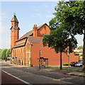
Watson Fothergill's Woodborough Road Baptist Church
The church is now an Islamic Centre. Built in bright Nottingham Patent Brick in a characteristically idiosyncratic Romanesque style, it is Grade II listed: http://www.britishlistedbuildings.co.uk/en-459123-woodborough-road-islamic-social-centre-#.VZUQViiwHZY
For more about Fothergill, and photographs of his buildings, see http://www.geograph.org.uk/article/The-Buildings-of-Watson-Fothergill .
Image: © John Sutton
Taken: 1 Jul 2015
0.10 miles
9
Roman Catholic Church of St Augustine, Woodborough
Built in 1920-23 in a rather eclectic Romanesque style, Listed Grade II. The original designs show that the two towers either side of the main entrance were intended to be taller with a connecting arch. The flat light when this view was taken means that the white domes, visible in this view, https://www.geograph.org.uk/photo/4043385 are indistinguishable from the sky, contributing to the rather truncated appearance of the church.
Image: © Alan Murray-Rust
Taken: 27 Nov 2022
0.11 miles
10
Robin Hood Chase, looking north from Abbotsford Drive Subway
Part of the series of pedestrian avenues created in 1851 as a result of the recent Inclosures to the north of the City centre. These are lime trees.
Image: © Alan Murray-Rust
Taken: 27 Nov 2022
0.11 miles


