
IMAGES TAKEN NEAR TO
Holdingham Lane, SLEAFORD, NG34 8SW
Introduction
This page details the photographs taken nearby to Holdingham Lane, NG34 8SW by members of the Geograph project.
The Geograph project started in 2005 with the aim of publishing, organising and preserving representative images for every square kilometre of Great Britain, Ireland and the Isle of Man.

There are currently over 7.5m images from over14,400 individuals and you can help contribute to the project by visiting https://www.geograph.org.uk
Image Map
Images are licensed for reuse under creativecommons.org/licenses/by-sa/2.0
Notes
- Clicking on the map will re-center to the selected point.
- The higher the marker number, the further away the image location is from the centre of the postcode.
Image Listing (35 Images Found)
Images are licensed for reuse under creativecommons.org/licenses/by-sa/2.0
Image
Details
Distance
1
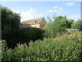
Holdingham Mill
Former mill buildings https://historicengland.org.uk/listing/the-list/list-entry/1360440
Image: © Jonathan Thacker
Taken: 28 Aug 2021
0.02 miles
2
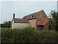
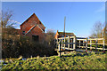
Holdingham Mill
A 19th century Grade 2 listed corn mill, with what looks like a low breast-shot waterwheel.
Image: © Christine Johnstone
Taken: 14 Aug 2020
0.02 miles
3
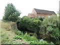
Corn Mill Lock and Holdingham Mill
When the River Slea was made navigable in 1794, a lock was built next to the weir of each riverside watermill. The mill is Grade 2 listed.
Image: © Christine Johnstone
Taken: 14 Aug 2020
0.02 miles
4
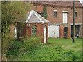
Toll house on the river Slea
The old toll house on the Slea navigation at corn mill lock. Disused flour mill in the background.
Image: © Jim Thornton
Taken: 26 Feb 2006
0.03 miles
5
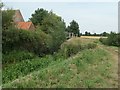
Upstream entrance to Corn Mill Lock, Sleaford Navigation
The Sleaford Navigation is a canalised section of the River Slea. It opened in May 1794. There were seven locks, each 60 ft long and 15 ft wide [18.3 x 4.6m]. Coal came into Sleaford from all over the East Midlands, and grain went out, mainly to Nottinghamshire. Boats stopped using this section in 1881, but the Sleaford Navigation Trust is now seeking to restore the navigation.
Image: © Christine Johnstone
Taken: 14 Aug 2020
0.03 miles
7
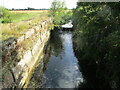
The remains of Corn Mill Lock
Part of the Sleaford Navigation. The canal opened in 1794 and closed in 1881. https://en.wikipedia.org/wiki/Sleaford_Navigation
Image: © Jonathan Thacker
Taken: 28 Aug 2021
0.04 miles
8
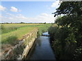
The former Corn Mill Lock, Sleaford Navigation
Long out of use (1880s) though there are hopes of restoration.
Image: © Jonathan Thacker
Taken: 3 Jul 2019
0.04 miles
9
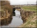
Corn mill lock
The disused chamber of Corn mill lock on the river Slea. Note the weir at the lock entrance
Image: © Jim Thornton
Taken: 26 Feb 2006
0.04 miles
10
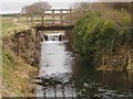
Corn mill lock
The lock chamber viewed from downstream. The footbridge over the lock, and the weir at the lock entrance can be seen.
Image: © Jim Thornton
Taken: 26 Feb 2006
0.06 miles