IMAGES TAKEN NEAR TO
Brauncewell, SLEAFORD, NG34 8RH
Introduction
This page details the photographs taken nearby to NG34 8RH by members of the Geograph project.
The Geograph project started in 2005 with the aim of publishing, organising and preserving representative images for every square kilometre of Great Britain, Ireland and the Isle of Man.

There are currently over 7.5m images from over14,400 individuals and you can help contribute to the project by visiting https://www.geograph.org.uk
Image Map
Images are licensed for reuse under creativecommons.org/licenses/by-sa/2.0
Notes
- Clicking on the map will re-center to the selected point.
- The higher the marker number, the further away the image location is from the centre of the postcode.
Image Listing (10 Images Found)
Images are licensed for reuse under creativecommons.org/licenses/by-sa/2.0
Image
Details
Distance
1
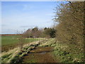
Former road near School Row
The tarmac is largely covered by vegetation.
Image: © Jonathan Thacker
Taken: 6 Apr 2015
0.02 miles
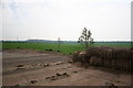
2
Old School?
The 1940s OS map shows a school being located here. The chimneys in the trees could be part of this?
Image: © Michael Patterson
Taken: 4 Aug 2006
0.02 miles
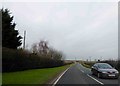
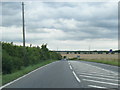
5
Looking towards the A15
The A15 is beyond the distant hedge.
Image: © Jonathan Thacker
Taken: 6 Apr 2015
0.19 miles
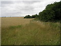
7
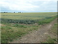
Large wheatfield, south of Dunsby Pit Plantation
On the south side of the Brauncewell road.
Image: © Christine Johnstone
Taken: 3 Jul 2022
0.24 miles
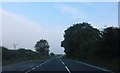
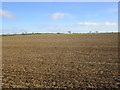
8
Brauncewell A15
The A15 at Brauncewell .... driving it is bad enough, cycling is downright scary !
Image: © Richard Croft
Taken: 16 Jan 2014
0.24 miles
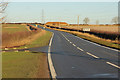
9
From Brauncewell Lane End
Looking towards Manor House Plantation from where Brauncewell Lane meets the A15
Image: © Richard Croft
Taken: 8 May 2006
0.24 miles
10
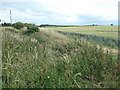
Uncultivated land between a lane and a field
Roadside verge or uncultivated field margin? Difficult to tell.
Image: © Christine Johnstone
Taken: 3 Jul 2022
0.25 miles