
IMAGES TAKEN NEAR TO
King Edward Street, SLEAFORD, NG34 7NF
Introduction
This page details the photographs taken nearby to King Edward Street, NG34 7NF by members of the Geograph project.
The Geograph project started in 2005 with the aim of publishing, organising and preserving representative images for every square kilometre of Great Britain, Ireland and the Isle of Man.

There are currently over 7.5m images from over14,400 individuals and you can help contribute to the project by visiting https://www.geograph.org.uk
Image Map
Images are licensed for reuse under creativecommons.org/licenses/by-sa/2.0
Notes
- Clicking on the map will re-center to the selected point.
- The higher the marker number, the further away the image location is from the centre of the postcode.
Image Listing (52 Images Found)
Images are licensed for reuse under creativecommons.org/licenses/by-sa/2.0
Image
Details
Distance
1
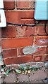
Benchmark on jut on St Edmunds Road face of #73 Grantham Road
Ordnance Survey cut mark benchmark levelled at 22.250m above Newlyn Datum verified 1966
Image: © Roger Templeman
Taken: 27 Jun 2023
0.06 miles
2
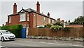
Nos. 73 and 71 Grantham Road viewed from St Edmunds Road
There is an Ordnance Survey benchmark Image on the right hand side of the jut on the left hand face of the nearer house (behind the blue gate)
Image: © Roger Templeman
Taken: 27 Jun 2023
0.07 miles
3
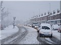
Happy motoring!
Sleaford commuter traffic queueing along Grantham Road on an unusually snowy morning.
Image: © Ian Paterson
Taken: 18 Dec 2009
0.10 miles
4
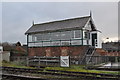
Sleaford West Signal Box
One of four in the area.
* Update 2014 - Due to engineering works over the course of 2014, the north and south boxes have been decommissioned.
Image: © Ashley Dace
Taken: 21 Nov 2010
0.11 miles
5
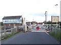
Sleaford West level crossing
Sleaford West signal box and level crossing gates, King Edward Street, Sleaford.
Image: © Malc McDonald
Taken: 11 Sep 2010
0.11 miles
6
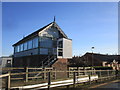
Sleaford West signalbox
At the junction of the lines to Grantham and Lincoln.
Image: © Jonathan Thacker
Taken: 20 Jan 2020
0.11 miles
7
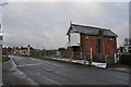
Sleaford West Signal Box
One of four in the area.
Image: © Ashley Dace
Taken: 21 Nov 2010
0.11 miles
8
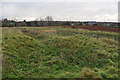
Sleaford Castle
One of the ditches, inner bailey to the right. The Sleaford west signal box is to the right.
http://www.sleaford.gov.uk/castle.html
Image: © Ashley Dace
Taken: 21 Nov 2010
0.11 miles
9
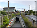
Sleaford West level crossing subway
The presence of the subway is indicative of a much more extensive volume of rail traffic than exists today, together with substantial pedestrian/cycle traffic.
Image: © Alan Murray-Rust
Taken: 5 Aug 2012
0.11 miles
10
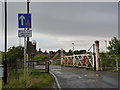
Sleaford West level crossing
This retains a fine set of traditional gates, still with a cast iron gatepost supporting the near gate. The combination of 3 railway tracks and the narrow road means that there are gates on one side of the road only.
Image: © Alan Murray-Rust
Taken: 5 Aug 2012
0.12 miles