IMAGES TAKEN NEAR TO
Mareham Lane, SLEAFORD, NG34 0AT
Introduction
This page details the photographs taken nearby to Mareham Lane, NG34 0AT by members of the Geograph project.
The Geograph project started in 2005 with the aim of publishing, organising and preserving representative images for every square kilometre of Great Britain, Ireland and the Isle of Man.

There are currently over 7.5m images from over14,400 individuals and you can help contribute to the project by visiting https://www.geograph.org.uk
Image Map
Images are licensed for reuse under creativecommons.org/licenses/by-sa/2.0
Notes
- Clicking on the map will re-center to the selected point.
- The higher the marker number, the further away the image location is from the centre of the postcode.
Image Listing (10 Images Found)
Images are licensed for reuse under creativecommons.org/licenses/by-sa/2.0
Image
Details
Distance
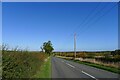
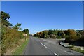
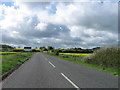
2
Looking south along Mareham Lane
Mareham Lane shows the characteristics of the old Roman road at this point. Keeper's Cottage is in a prominent position with fine views across the Lincolnshire countryside.
Image: © Kate Jewell
Taken: 11 Feb 2007
0.08 miles
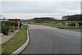
3
Mareham Lane passing Highfields Country Fishing Retreat
From this point to its end at Sleaford, 5 miles to the north, Mareham Lane is followed by parish boundaries, a common feature of Roman roads.
Image: © Tim Heaton
Taken: 10 Oct 2022
0.08 miles
4
Whitehouse Plantation
Looking across farmland to Whitehouse Plantation from Mareham Lane. The wood lies right on the southern boundary of the square. Spanby Wood is on the horizon.
Image: © Kate Jewell
Taken: 11 Feb 2007
0.13 miles
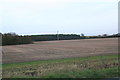
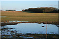
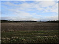
5
Crop field towards Hillside Plantation
East of Mareham Lane Roman Road.
Image: © JThomas
Taken: 26 Oct 2013
0.13 miles
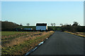
6
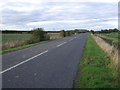
Mareham Lane heading north
On the Roman Road towards Sleaford.
Image: © JThomas
Taken: 26 Oct 2013
0.16 miles
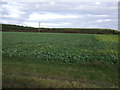
8
Stubble field near Spanby
Willow Holt and Hillside Plantation in the background.
Image: © Jonathan Thacker
Taken: 21 Dec 2019
0.17 miles