
IMAGES TAKEN NEAR TO
Station Road, GRANTHAM, NG33 4SB
Introduction
This page details the photographs taken nearby to Station Road, NG33 4SB by members of the Geograph project.
The Geograph project started in 2005 with the aim of publishing, organising and preserving representative images for every square kilometre of Great Britain, Ireland and the Isle of Man.

There are currently over 7.5m images from over14,400 individuals and you can help contribute to the project by visiting https://www.geograph.org.uk
Image Map
Images are licensed for reuse under creativecommons.org/licenses/by-sa/2.0
Notes
- Clicking on the map will re-center to the selected point.
- The higher the marker number, the further away the image location is from the centre of the postcode.
Image Listing (132 Images Found)
Images are licensed for reuse under creativecommons.org/licenses/by-sa/2.0
Image
Details
Distance
1
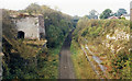
Castle Bytham: site/remains of station, 1986
View westward, towards Saxby: ex-Midland Saxby - Bourne line, Midland & Great Northern (M&GN) from just east of here, closed entirely 2/3/59.
Image: © Ben Brooksbank
Taken: 12 Oct 1986
0.05 miles
2
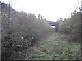
Castle Bytham railway station (site), Lincolnshire
Opened in 1898 by the Midland Railway on the line from the Saxby to Bourne, this station closed in 1959.
View east towards Bourne, Melton Constable etc. The one platform was immediately to the left with a sloping path up to road level.
Image: © Nigel Thompson
Taken: 11 Nov 2012
0.06 miles
3
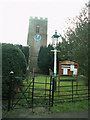
St James
Because of the geography of the village, the entrance to St James' church is unusual in being on the north side. The kissing gate gives onto a path through the yews, up to the porch which cannot be seen here. The tower is at the west end, and the nave continues to the left of the picture behind the yews, toward the east.
Image: © Bob Harvey
Taken: 1 Jan 2006
0.06 miles
4
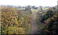
Trackbed eastward from Castle Bytham towards Bourne, 1986
Until the whole Midland & Great Northern system was closed from 2/3/59, this is where the ex-Midland Railway from Saxby, hence Melton Mowbray, Leicester and Nottingham, joined it: Castle Bytham station was just behind the photographer.
Image: © Ben Brooksbank
Taken: 12 Oct 1986
0.07 miles
5
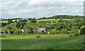
Farmland, Castle Bytham
The castle earthworks can be seen beyond the houses (Image]).
Image: © Stephen Richards
Taken: 18 Jun 2015
0.07 miles
6
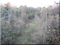
Castle Bytham railway station (site), Lincolnshire
Opened in 1898 by the Midland Railway on the line from the Saxby to Bourne, this station closed in 1959.
View west from Station Road overbridge towards South Witham and Saxby Junction. The one platform was to the right with a sloping path down from road level.
Image: © Nigel Thompson
Taken: 11 Nov 2012
0.08 miles
7
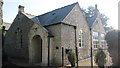
Former school, Castle Bytham
Primary school opened in 1814 and closed in 1974. The stone entrance has "1907" in the keystone. The school children from the village go to Little Bytham nowadays. For many years the school was also the village public library.
The school stood empty for many years over a dispute about ownership, but it is now a private house.
Image: © Bob Harvey
Taken: 7 Mar 2011
0.08 miles
8
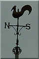
Church weathercock
St Stephen's church weathercock
Image: © Bob Harvey
Taken: 1 Jan 2006
0.09 miles
9
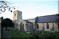
St.James' church
Cruciform church with Early English 13th century west tower & nave and a 14th century Decorated chancel
Image: © Richard Croft
Taken: 24 Nov 2008
0.09 miles
10
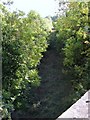
Railway Trackbed, Castle Bytham
A view north-west of the trackbed of the former Midland & Great Northern Joint Railway from Bourne to Saxby. Viewed from Bridge 37, Station Road, which would indicate that this was probably the site of the station.
Image: © Stephen Armstrong
Taken: 4 Oct 2009
0.09 miles