IMAGES TAKEN NEAR TO
Watkin Street, NOTTINGHAM, NG3 1DL

Introduction

This page details the photographs taken nearby to Watkin Street, NG3 1DL by members of the Geograph project.

The Geograph project started in 2005 with the aim of publishing, organising and preserving representative images for every square kilometre of Great Britain, Ireland and the Isle of Man.

There are currently over 7.5m images from over14,400 individuals and you can help contribute to the project by visiting https://www.geograph.org.uk

Image Map


Images are licensed for reuse under creativecommons.org/licenses/by-sa/2.0
Notes
  • Clicking on the map will re-center to the selected point.
  • The higher the marker number, the further away the image location is from the centre of the postcode.

Image Listing (214 Images Found)

Images are licensed for reuse under creativecommons.org/licenses/by-sa/2.0
  • ...
Image
Details
Distance
1
Huntington Street, Nottingham
Image: © JThomas Taken: 1 Jul 2010
0.06 miles
2
Victoria Centre, Nottingham
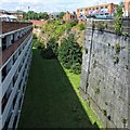
Looking into the deep cutting of what was once the Great Central Railway's Victoria Station. To the left a multi-storey car park and to the right the massive retaining wall.
Image: © Dave Hitchborne Taken: 11 Aug 2009
0.06 miles
3
Nottingham - NG3
The former premises of Harrison Co. Ltd, lace dressers, on Great Freeman Street (off the Huntingdon Street on the fringe of the city centre). It is currently used as a new stock warehouse by Hopewells, the up-market furniture retailer.
Image: © David Hallam-Jones Taken: 21 Apr 2012
0.06 miles
4
Victoria Centre car park
Image: © Bryn Holmes Taken: 15 Jan 2018
0.06 miles
5
Victoria Centre car park
Image: © Bryn Holmes Taken: 18 Jan 2018
0.07 miles
6
Hopewells, Huntingdon Street
This rather eccentric piece of architecture houses a home furniture shop and is adorned with a very minimalistic clock.
Image: © Richard Vince Taken: 28 Jun 2012
0.07 miles
7
St Ann's Inn, St Ann's Nottingham
A fairly typical Nottingham 1970s/1980s estate pub. Built as part of the re-development of the St. Ann's area in the 1970s.
Image: © SK53 Taken: 26 Apr 2011
0.08 miles
8
Big Blue Brick Buttress
Retaining wall for the cutting in which Nottingham's Victoria Station was built. The Station site is now occupied by the Victoria Centre, a large modern centre with flats over and multi-storey car parks. Parts of the latter occupy the northern part of the site where this view is taken.
Image: © Alan Murray-Rust Taken: 8 Mar 2009
0.08 miles
9
Where Nottingham Victoria Station used to be
A view of the Victoria Centre from the junction of Woodborough Road and Huntingdon Street. Beyond the wall in the foreground the Great Central Railway excavated a huge hole in the sandstone in which Victoria Station stood until it was demolished in the late 1960s and replaced by the Victoria Centre. The main entrance to the station was on Mansfield Road, but only the copper-domed clock tower (just left of centre) remains.
Image: © John Sutton Taken: 1 Jul 2015
0.08 miles
10
Nottingham - NG1
The dwarfed cream-coloured "New Foresters" pub now sits at the side of the pedestrianised St Ann's Street. In the foreground a semi-circular branch of the A60 sweeps out to rejoin Huntingdon Street again as part of a one-way traffic system. Overshadowing these two "green" islands a handful of specimens of post-modern architecture loom in the background.
Image: © David Hallam-Jones Taken: 21 Apr 2012
0.08 miles
  • ...