IMAGES TAKEN NEAR TO
Cold Harbour Lane, GRANTHAM, NG31 7TW
Introduction
This page details the photographs taken nearby to Cold Harbour Lane, NG31 7TW by members of the Geograph project.
The Geograph project started in 2005 with the aim of publishing, organising and preserving representative images for every square kilometre of Great Britain, Ireland and the Isle of Man.

There are currently over 7.5m images from over14,400 individuals and you can help contribute to the project by visiting https://www.geograph.org.uk
Image Map
Images are licensed for reuse under creativecommons.org/licenses/by-sa/2.0
Notes
- Clicking on the map will re-center to the selected point.
- The higher the marker number, the further away the image location is from the centre of the postcode.
Image Listing (8 Images Found)
Images are licensed for reuse under creativecommons.org/licenses/by-sa/2.0
Image
Details
Distance
2
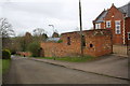
Brick wall bounding #33 Coldharbour Lane
The wall was formerly part of buildings of St Vincent's offices
Image: © Roger Templeman
Taken: 7 Apr 2016
0.08 miles
3
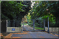
The gates to St. Vincent's Hall, Grantham
During the Second World War St Vincent's Hall was requisitioned by the RAF as No. 5 Bomber Group between October 1937 and November 1943 as operations Headquarters.
In 1944 the building became headquarters for the USAAF's Ninth Air Force's IX Troop Carrier Command.
It became surplus to requirements in 1964 as was sold to South Kesteven District for use as council offices.
Today it is a private residence.
https://en.wikipedia.org/wiki/St_Vincents_Hall
Image: © Adrian S Pye
Taken: 8 Sep 2019
0.15 miles
4
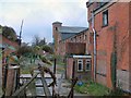
Disused malthouse
Disused malthouse at Grantham
Image: © Steve Edge
Taken: 2 Dec 2005
0.19 miles