IMAGES TAKEN NEAR TO
Hanbury Avenue, GRANTHAM, NG31 7GS
Introduction
This page details the photographs taken nearby to Hanbury Avenue, NG31 7GS by members of the Geograph project.
The Geograph project started in 2005 with the aim of publishing, organising and preserving representative images for every square kilometre of Great Britain, Ireland and the Isle of Man.

There are currently over 7.5m images from over14,400 individuals and you can help contribute to the project by visiting https://www.geograph.org.uk
Image Map
Images are licensed for reuse under creativecommons.org/licenses/by-sa/2.0
Notes
- Clicking on the map will re-center to the selected point.
- The higher the marker number, the further away the image location is from the centre of the postcode.
Image Listing (24 Images Found)
Images are licensed for reuse under creativecommons.org/licenses/by-sa/2.0
Image
Details
Distance
1
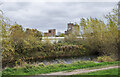
Industrial buildings beyond Grantham Canal
The section of the Grantham Canal in the image is the isolated end of the waterway in the town, separated from the main length of it by the construction of the A1 bypass a short distance to the right, out of the image.
Image: © Trevor Littlewood
Taken: 10 Nov 2022
0.06 miles
3

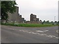
Volcanic Ash Enhanced Sunset taken from Elvaston Court, Grantham
There was a lot of talk about volcanic ash from the Icelandic Eruption causing spectacular susnsets, this was taken from my window in Elvaston Court in Grantham
Image: © Kenny Howse
Taken: 17 Apr 2010
0.15 miles
4
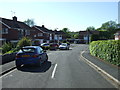
Residential close off Harlaxton Road, Grantham
Image: © JThomas
Taken: 26 May 2012
0.15 miles
5
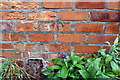
Damaged benchmark on #141 Huntingtower Road
Ordnance Survey cut mark benchmark described on the Bench Mark Database at www.bench-marks.org.uk/bm111446
Image: © phil Richards
Taken: 9 Sep 2019
0.16 miles
6
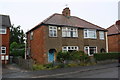
Nos. 141 and 139 Huntingtower Road
There is an Ordnance Survey benchmark Image on the left hand side of the left hand house near its front corner
Image: © phil Richards
Taken: 9 Sep 2019
0.16 miles
7
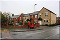
Springfield Road at Harris Way junction
Ordnance Survey records indicate that in 1951 there was a social club here on which a benchmark was cut. See www.bench-marks.org.uk/bm116241
Image: © phil Richards
Taken: 9 Sep 2019
0.17 miles
8
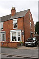
#78 Huntingtower Road
There is an OS benchmark Image on the side of the house at the near corner
Image: © Roger Templeman
Taken: 19 Apr 2014
0.17 miles
9
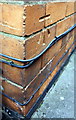
Benchmark on #78 Huntingtower Road
Ordnance Survey cut mark benchmark described on the Bench Mark Database at http://www.bench-marks.org.uk/bm57027
Image: © Roger Templeman
Taken: 24 May 2014
0.17 miles