
IMAGES TAKEN NEAR TO
Castlegate, GRANTHAM, NG31 6AB
Introduction
This page details the photographs taken nearby to Castlegate, NG31 6AB by members of the Geograph project.
The Geograph project started in 2005 with the aim of publishing, organising and preserving representative images for every square kilometre of Great Britain, Ireland and the Isle of Man.

There are currently over 7.5m images from over14,400 individuals and you can help contribute to the project by visiting https://www.geograph.org.uk
Image Map
Images are licensed for reuse under creativecommons.org/licenses/by-sa/2.0
Notes
- Clicking on the map will re-center to the selected point.
- The higher the marker number, the further away the image location is from the centre of the postcode.
Image Listing (685 Images Found)
Images are licensed for reuse under creativecommons.org/licenses/by-sa/2.0
Image
Details
Distance
1
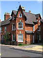
Grantham - corner house on Elysian Terrace
Image: © Dave Bevis
Taken: 26 Jul 2012
0.01 miles
2
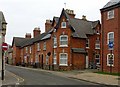
Elysian Terrace, Castlegate, Grantham
A distinctive terrace of slate roofed bright red brick terraced houses, dated 1873 with the initials CP on the corner house.
Image: © Alan Murray-Rust
Taken: 9 Feb 2017
0.01 miles
3
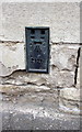
Benchmark on building at Castlegate/Finkin Street junction
Ordnance Survey flush bracket (serial number 2126) benchmark described on the Bench Mark Database at http://www.bench-marks.org.uk/bm1820
Image: © Roger Templeman
Taken: 19 Apr 2014
0.02 miles
4
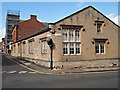
Finkin Street, Grantham, Lincs.
This building on Finkin Street, with its gable end on Castlegate, has seen service as school, a gentlemens' club (The Blues & Khaki Club), the premises of a printing company and at present it is the home of Brown & Co., Land Valuers and Estate Agents. The main entrance to the premises now are now via the colonnaded porch at front of the two-storey, red-brick Georgian (?) house on Finkin Street.
Image: © David Hallam-Jones
Taken: 9 Aug 2016
0.02 miles
5
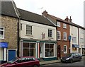
14-16 Castlegate, Grantham
No.14 is an early 19th century house with later shop front. Not an exciting looking building, but still Listed Grade II. 15 and 16 also Listed Grade II, although no.16 has had its windows unsympathetically modernised.
Image: © Alan Murray-Rust
Taken: 9 Feb 2017
0.02 miles
6
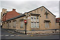
Junction of Finkin Street and Castlegate
There is an OS benchmark Image on the Castlegate face below the hydrant sign.
Image: © Roger Templeman
Taken: 19 Apr 2014
0.02 miles
7
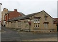
Former school, Finkin Street
Simply recorded as an Infants' School on old maps. An attractive mid 19th century building in Victorian Tudor Gothic style, but not deemed worthy of listing.
Image: © Alan Murray-Rust
Taken: 9 Feb 2017
0.02 miles
8
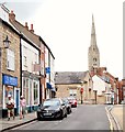
Finkin Street Vicinity, Grantham, Lincs.
Stationary cars on Castlegate near its junction with Finkin Street. St Wulrum's Church, in the distance, can be reached by continuing along on Castlegate on foot, this being a one-way street.
Image: © David Hallam-Jones
Taken: 4 Aug 2019
0.02 miles
9
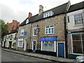
Castlegate, Grantham
The stone built houses date from the eighteenth century https://historicengland.org.uk/listing/the-list/list-entry/1062514?section=official-list-entry
Image: © Jonathan Thacker
Taken: 14 Jul 2019
0.02 miles
10
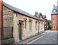
Finkin Street, Grantham, Lincs.
Could the word finkin be a corruption of the word firkin, a former brewery measure, arising from a misspelling of this word in an ancient document, that was allowed to remain uncorrected thereafter? It seems that there were once maltings in Vine Street, a parallel road to this one. The brown brick building behind the railings is a large, much taller building occupied by a firm of land and property agents. This company also occupies this single storey building, whose previous function may have been that of a church hall or an "institute' of some type? Castlegate is the road ahead.
Image: © David Hallam-Jones
Taken: 4 Aug 2019
0.03 miles