
IMAGES TAKEN NEAR TO
Leigh Close, NOTTINGHAM, NG2 7TN
Introduction
This page details the photographs taken nearby to Leigh Close, NG2 7TN by members of the Geograph project.
The Geograph project started in 2005 with the aim of publishing, organising and preserving representative images for every square kilometre of Great Britain, Ireland and the Isle of Man.

There are currently over 7.5m images from over14,400 individuals and you can help contribute to the project by visiting https://www.geograph.org.uk
Image Map
Images are licensed for reuse under creativecommons.org/licenses/by-sa/2.0
Notes
- Clicking on the map will re-center to the selected point.
- The higher the marker number, the further away the image location is from the centre of the postcode.
Image Listing (74 Images Found)
Images are licensed for reuse under creativecommons.org/licenses/by-sa/2.0
Image
Details
Distance
1
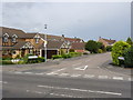
Lydney Park
Typical cul-de-sac in the Compton Acres development with timber slat decoration.
Image: © Alan Murray-Rust
Taken: 27 Jun 2012
0.05 miles
2
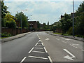
Compton Acres
Looking south from the junction with Wilford Lane. This is one of the principal roads in the large housing development on the north-western slopes of Wilford Hill.
Image: © Alan Murray-Rust
Taken: 29 May 2009
0.09 miles
3
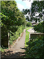
Footpath at Cranberry Close
Looking out from the old railway embankment.
Image: © Alan Murray-Rust
Taken: 29 May 2009
0.10 miles
4
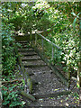
Footpath at Cranberry Close
The steps up onto the old railway embankment, which will be removed for the proposed tram route to Clifton.
Image: © Alan Murray-Rust
Taken: 29 May 2009
0.12 miles
5

Yellow Loosestrife (Lysimachia vulgaris)
On the footpath along the old railway alignment.
Image: © Alan Murray-Rust
Taken: 29 May 2009
0.12 miles
6
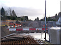
Looking south from Wilford Lane
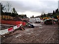
The track in the crossing with Wilford Lane is now installed; work continues on the section southwards.
Image: © Alan Murray-Rust
Taken: 13 Jan 2014
0.14 miles
8
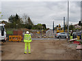
Wilford Lane road crossing
Looking south from the temporary pedestrian route. South of the crossing track is in place and poles have been erected. The junction visible gives access to a siding which can be used for engineers' vehicles.
Image: © Alan Murray-Rust
Taken: 4 Apr 2014
0.15 miles
9
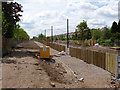
South of Wilford Lane
Work on erecting the overhead wires continues. The fencing is designed to provide sound absorption to minimise the effect on the residential properties on both sides of the line.
Image: © Alan Murray-Rust
Taken: 14 May 2014
0.15 miles
10
Compton Acres junction on Wilford Lane
The north end of Compton Acres (left) where it meets Wilford Lane just east of Wilford. On the right can be seen the embankment that once carried the Great Central Railway's London extension. Hidden by vegetation until recently (see Image), it is now in the process of being removed for the construction of a tramway (see Image).
Image: © Richard Vince
Taken: 1 Sep 2012
0.15 miles