1
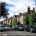
Victorian Villa
A fine example with superb decorative brickwork on Loughborough Road.
Image: © Alan Murray-Rust
Taken: 23 Sep 2008
0.01 miles
2
Victorian Villas
The substantial Victorian houses on this part of Loughborough are now entirely converted to commercial properties,
Image: © Alan Murray-Rust
Taken: 23 Sep 2008
0.02 miles
3
Balmoral Avenue Nottingham
Image: © Roy Hughes
Taken: 16 Apr 2022
0.04 miles
4
East end of Wilford Lane, West Bridgford
The junction of Loughborough Road and Wilford Lane (left); the beginning of Melton Road is just out of view to the right. The verdant raised bed on the right blocks the end of Patrick Road, one of many roads in West Bridgford named after children of the landowners who first developed the suburb.
Image: © Richard Vince
Taken: 1 Sep 2012
0.04 miles
5
Patrick Road
The end of this road was blocked some years ago due to the complexity of the road junction at this point.
Image: © Alan Murray-Rust
Taken: 7 Mar 2010
0.05 miles
6
Wet Bridgford and Wilford Hill
A very heavy shower had interrupted play on the third afternoon of the Nottinghamshire-Sussex match at Trent Bridge. This long zoom view of wet West Bridgford from the Radcliffe Road End shows in the foreground houses in the roads off Loughborough Road, and beyond them newer houses on the northern slope of Wilford Hill, which is topped by the chapel at the Southern Cemetery, about two miles away. Much of Bridgford was built in the late Victorian and Edwardian periods; expansion southwards to Edwalton and Wilford Hill came between and after the wars.
Image: © John Sutton
Taken: 29 Jul 2012
0.06 miles
7
West Bridgford: Patrick Road sunset
Looking towards Loughborough Road and the Wilford Lane junction at 7.55 on a mild September evening. The red sky presaged lovely weather the following day.
Image: © John Sutton
Taken: 16 Sep 2019
0.07 miles
8
West Bridgford: waiting for the lights on Wilford Lane
Traffic waiting to turn on to Loughborough Road (left for the city) or Melton Road on a bright mid-September morning. The No 1 South Notts bus has come from Loughborough. South Notts was once an independent bus company based in Gotham, but the No 1 is now operated by Nottingham City Transport.
Image: © John Sutton
Taken: 13 Sep 2018
0.07 miles
9
West Bridgford: Henry Road
In the last quarter of the 19th century and the early years of the 20th Bridgford expanded from a small village to a large and prosperous suburb with its own Urban District Council. These genteel red-brick villas are typical.
Image: © John Sutton
Taken: 3 Jul 2016
0.07 miles
10
West Bridgford: early evening on Patrick Road
Looking towards Musters Road.
Image: © John Sutton
Taken: 16 Sep 2019
0.07 miles


