
IMAGES TAKEN NEAR TO
Burnside Road, NOTTINGHAM, NG2 7HW
Introduction
This page details the photographs taken nearby to Burnside Road, NG2 7HW by members of the Geograph project.
The Geograph project started in 2005 with the aim of publishing, organising and preserving representative images for every square kilometre of Great Britain, Ireland and the Isle of Man.

There are currently over 7.5m images from over14,400 individuals and you can help contribute to the project by visiting https://www.geograph.org.uk
Image Map
Images are licensed for reuse under creativecommons.org/licenses/by-sa/2.0
Notes
- Clicking on the map will re-center to the selected point.
- The higher the marker number, the further away the image location is from the centre of the postcode.
Image Listing (31 Images Found)
Images are licensed for reuse under creativecommons.org/licenses/by-sa/2.0
Image
Details
Distance
1
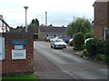
Rugby Road Community Centre
Included as part of a development of maisonette blocks.
Image: © Alan Murray-Rust
Taken: 23 Sep 2008
0.06 miles
2
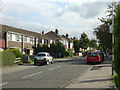
Kingswood Road
1950s/60s housing development.
Image: © Alan Murray-Rust
Taken: 23 Sep 2008
0.07 miles
3
Traffic lights on Loughborough Road, Nottingham
Image: © Steve Fareham
Taken: 17 Oct 2013
0.08 miles
4
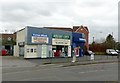
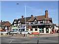
Shops on the corner of Eton Road
There is a bench mark http://www.geograph.org.uk/photo/5291002 on the brickwork under the Corner Blinds sign.
Image: © Alan Murray-Rust
Taken: 20 Feb 2017
0.11 miles
5
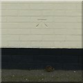
Bench mark, 197 Loughborough Road, West Bridgford
See http://www.geograph.org.uk/photo/5291005 for location.
Image: © Alan Murray-Rust
Taken: 20 Feb 2017
0.11 miles
7
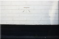
Benchmark on #197 Loughborough Road (Eton Road face)
Ordnance Survey cut mark benchmark described on the Bench Mark Database at https://www.bench-marks.org.uk/bm82489
Image: © Roger Templeman
Taken: 14 May 2018
0.11 miles
8
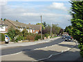
Rugby Road
One of several roads locally named after British public schools. This is the main access to the housing estates to the west of Loughborough Road.
Image: © Alan Murray-Rust
Taken: 23 Sep 2008
0.12 miles
9
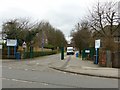
Entrance to West Bridgford School, Loughborough Road
There is a bench mark http://www.geograph.org.uk/photo/5290998 on the brick gatepost at the right hand side of the picture.
Image: © Alan Murray-Rust
Taken: 20 Feb 2017
0.12 miles
10
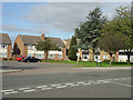
Rugby Road maisonettes
Typical 1950s maisonettes. Residents' parking is catered for by a communal parking area.
Image: © Alan Murray-Rust
Taken: 23 Sep 2008
0.12 miles