IMAGES TAKEN NEAR TO
Stratford Road, NOTTINGHAM, NG2 6AZ
Introduction
This page details the photographs taken nearby to Stratford Road, NG2 6AZ by members of the Geograph project.
The Geograph project started in 2005 with the aim of publishing, organising and preserving representative images for every square kilometre of Great Britain, Ireland and the Isle of Man.

There are currently over 7.5m images from over14,400 individuals and you can help contribute to the project by visiting https://www.geograph.org.uk
Image Map
Images are licensed for reuse under creativecommons.org/licenses/by-sa/2.0
Notes
- Clicking on the map will re-center to the selected point.
- The higher the marker number, the further away the image location is from the centre of the postcode.
Image Listing (216 Images Found)
Images are licensed for reuse under creativecommons.org/licenses/by-sa/2.0
Image
Details
Distance
1
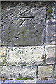
Benchmark on the tower of St Giles' Church
Ordnance Survey 1GL bolt benchmark described on the Bench Mark Database at http://www.bench-marks.org.uk/bm20254
Image: © Roger Templeman
Taken: 3 Apr 2013
0.01 miles
2
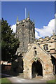
St Giles' Church
There is an OS benchmark Image on the tower face, and the flagstaff is an OS intersected station trig point, http://www.trigpointinguk.com/trigs/trig-details.php?t=11461
Image: © Roger Templeman
Taken: 3 Apr 2013
0.01 miles
3
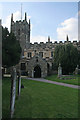
St Giles Church, West Bridgford
The south porch.
Image: © Kate Jewell
Taken: 22 Apr 2009
0.02 miles
4
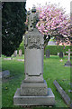
Monument, St Giles Church, West Bridgford
Image: © Kate Jewell
Taken: 22 Apr 2009
0.02 miles
5
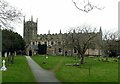
Church of St Giles, West Bridgford
The church has an unusual layout. The tower stands at the west end of what was the medieval nave, with clerestory and original south aisle (with low roof). To this was added towards the end of the 19th century a completely new nave and chancel, needed to cater the vastly expanded population of the town. The old nave and chancel now form a south aisle, incorporating the former medieval south aisle. Listed Grade II.
There is a bench mark http://www.geograph.org.uk/photo/3396516 on the south face of the tower, roughly behind the pedestrian.
Image: © Alan Murray-Rust
Taken: 20 Feb 2017
0.02 miles
6
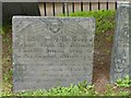
Belvoir Angel headstone, St Giles's Churchyard, West Bridgford
To Robert Clark, d.1705
Image: © Alan Murray-Rust
Taken: 20 Feb 2017
0.02 miles
7
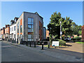
West Bridgford: a September morning on Stratford Road
Image] shows the houses to the left of centre being adapted in 2019.
Image: © John Sutton
Taken: 8 Sep 2021
0.02 miles
8
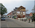
West Bridgford: building work on Stratford Road
The twitchel beyond the bollards on the right leads to Epperstone Road. The newer houses in the background on the right were built after the levelling of the embankment which once carried the Nottingham to Melton Mowbray railway through Bridgford.
Image: © John Sutton
Taken: 8 Apr 2019
0.02 miles