
IMAGES TAKEN NEAR TO
Orston Road, NOTTINGHAM, NG2 5FU
Introduction
This page details the photographs taken nearby to Orston Road, NG2 5FU by members of the Geograph project.
The Geograph project started in 2005 with the aim of publishing, organising and preserving representative images for every square kilometre of Great Britain, Ireland and the Isle of Man.

There are currently over 7.5m images from over14,400 individuals and you can help contribute to the project by visiting https://www.geograph.org.uk
Image Map
Images are licensed for reuse under creativecommons.org/licenses/by-sa/2.0
Notes
- Clicking on the map will re-center to the selected point.
- The higher the marker number, the further away the image location is from the centre of the postcode.
Image Listing (567 Images Found)
Images are licensed for reuse under creativecommons.org/licenses/by-sa/2.0
Image
Details
Distance
1
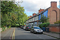
West Bridgford: Orston Road East
A short road, one of three named after villages in the Vale of Belvoir, off Radcliffe Road and near Nottingham Forest football ground.
Image: © John Sutton
Taken: 28 Sep 2022
0.01 miles
2
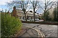
Orston Road East
These houses are right next door to Nottingham Forest's stadium, The City Ground.
Photograph taken from Scarrington Road.
Image: © Kate Jewell
Taken: 1 May 2008
0.04 miles
3
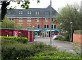
Former course of the Midland main line
This snap may only be of interest to bathroom or railway enthusiasts. The new building ahead stands where the Midland Railway main line from Nottingham to St Pancras via Melton Mowbray, Oakham, Corby and Kettering, closed in the 1960s, once crossed Radcliffe Road on a plate girder bridge. I stood where there was once an embankment to take the picture. The Melton line, which carried Nottingham's quickest London trains and brought iron ore north from Northamptonshire, turned south at London Road Junction, crossed the Trent on what is now the Lady Bay road bridge and ran north and south through West Bridgford, where its course shows clearly on the 1:25,000 map, and on the ground as a strip of new buildings built where there were once embankments.
Image] and Image] show remains of the line south of here.
Image: © John Sutton
Taken: 15 Apr 2011
0.04 miles
4
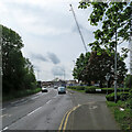
Building by the A6011
This road has crossed the River Trent on Lady Bay Bridge, originally a railway bridge and joins Radcliffe Road a short way ahead. The crane is on a site near the junction where one- and two-bedroom flats, Bridgford Point, are being built.
Image: © John Sutton
Taken: 23 May 2021
0.05 miles
5
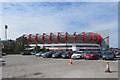
Nottingham Forest: the Bridgford Stand
When I was young the Bridgford End of Nottingham Forest's City Ground was an open terrace. Following the profitable success of Brian Clough's side in the 1970s and 80s (which included two European Cup wins) the ground was almost completely rebuilt.
Image: © John Sutton
Taken: 18 Sep 2019
0.06 miles
6
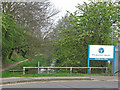
A truncated stretch of the Grantham Canal
This short stretch of the abandoned Grantham Canal runs behind the Forest football ground and joins the Trent just west of Lady Bay Bridge. Kate Jewell's Image] shows the lock there and Image] the Environment Agency office next to it, whose road entrance is here. To take the picture I stood roughly where the Nottingham-Melton-Kettering-St Pancras railway once crossed the canal. Behind the camera the canal has been filled in as far as the junction of Trent Boulevard and Radcliffe Road, where there was once a rather ornate bridge. Its reedy remains run parallel to Radcliffe Road from there to Gamston bridge.
Image: © John Sutton
Taken: 15 Apr 2011
0.06 miles
7
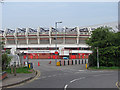
Nottingham Forest football ground
This is the Bridgford End of The City Ground. The end of the Brian Clough Stand shows above the bushes on the right. The road in the foreground is where, until the 1960s, a railway bridge crossed the Grantham Canal, one of whose truncated abandoned stretches is just to the right.
The Midland Railway Melton line, which carried Nottingham's quickest London trains and brought iron ore north from Northamptonshire, turned south at London Road Junction, crossed the Trent on what is now the Lady Bay road bridge and ran north and south through West Bridgford, where its course shows clearly on the 1:25,000 map, and on the ground as a strip of new buildings built where there were once embankments.
Image], Image] and Image] show remains of the line south of here.
Image: © John Sutton
Taken: 15 Apr 2011
0.06 miles
8
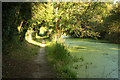
Grantham Canal and towpath
Short stretch of the disused Grantham Canal near the City Ground
Image: © Richard Croft
Taken: 9 Sep 2012
0.07 miles
9
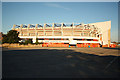
City Ground
Money Shop Bridgford Stand at the City Ground http://en.wikipedia.org/wiki/City_Ground
Image: © Richard Croft
Taken: 9 Sep 2012
0.07 miles
10
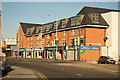
Radcliffe Road
Shops and flats on Radcliffe Road, West Bridgford
Image: © Richard Croft
Taken: 9 Sep 2012
0.07 miles