
Nottingham Forest football ground
Introduction
The photograph on this page of Nottingham Forest football ground by John Sutton as part of the Geograph project.
The Geograph project started in 2005 with the aim of publishing, organising and preserving representative images for every square kilometre of Great Britain, Ireland and the Isle of Man.

There are currently over 7.5m images from over 14,400 individuals and you can help contribute to the project by visiting https://www.geograph.org.uk
Nottingham Forest football ground
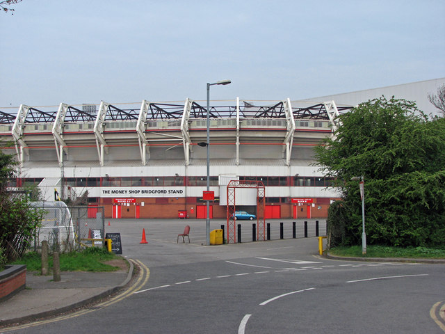
Image: © John Sutton Taken: 15 Apr 2011
This is the Bridgford End of The City Ground. The end of the Brian Clough Stand shows above the bushes on the right. The road in the foreground is where, until the 1960s, a railway bridge crossed the Grantham Canal, one of whose truncated abandoned stretches is just to the right. The Midland Railway Melton line, which carried Nottingham's quickest London trains and brought iron ore north from Northamptonshire, turned south at London Road Junction, crossed the Trent on what is now the Lady Bay road bridge and ran north and south through West Bridgford, where its course shows clearly on the 1:25,000 map, and on the ground as a strip of new buildings built where there were once embankments. Image], Image] and Image] show remains of the line south of here.
Images are licensed for reuse under creativecommons.org/licenses/by-sa/2.0
Image Location

Latitude
52.939728
Longitude
-1.131423