
IMAGES TAKEN NEAR TO
Seymour Road, NOTTINGHAM, NG2 5EG
Introduction
This page details the photographs taken nearby to Seymour Road, NG2 5EG by members of the Geograph project.
The Geograph project started in 2005 with the aim of publishing, organising and preserving representative images for every square kilometre of Great Britain, Ireland and the Isle of Man.

There are currently over 7.5m images from over14,400 individuals and you can help contribute to the project by visiting https://www.geograph.org.uk
Image Map
Images are licensed for reuse under creativecommons.org/licenses/by-sa/2.0
Notes
- Clicking on the map will re-center to the selected point.
- The higher the marker number, the further away the image location is from the centre of the postcode.
Image Listing (42 Images Found)
Images are licensed for reuse under creativecommons.org/licenses/by-sa/2.0
Image
Details
Distance
1

New Apostolic Church sign
Forming shadow patterns in the low December sunshine.
Image: © Alan Murray-Rust
Taken: 10 Dec 2021
0.06 miles
2
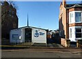
New Apostolic Church, Gertrude Road
One of just a couple of dozen of the NAC congregations in the UK. Not one of the many recently founded Pentecostal churches, its roots are catholic from the mid-19th century with a very diverse history https://en.wikipedia.org/wiki/New_Apostolic_Church
Image: © Alan Murray-Rust
Taken: 10 Dec 2021
0.06 miles
3
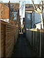
Twitchell in Lady Bay
Running across the road grid between Seymour Road and Mona Road.
(Twitchell is a local name for alleyways like this.)
Image: © Alan Murray-Rust
Taken: 10 Dec 2021
0.06 miles
4
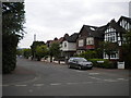
Adbolton Grove, Lady Bay
A residential road off Trent Boulevard near its eastern end.
Image: © Richard Vince
Taken: 10 Jun 2013
0.07 miles
5
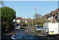
Adbolton Grove, West Bridgford
Designated as part of National Cycle Route 15 which currently (2021) is incomplete. The route is heading towards the River Trent where it makes use of off-road sections to avoid the heavy road traffic around Trent Bridge.
Image: © Alan Murray-Rust
Taken: 10 Dec 2021
0.09 miles
6
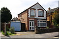
#148 Trent Boulevard
There is an OS benchmark Image in the bricks left of the house door
Image: © Roger Templeman
Taken: 12 May 2018
0.10 miles
7
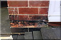
Benchmark on #148 Trent Boulevard
Ordnance Survey cut mark benchmark described on the Bench Mark Database at https://www.bench-marks.org.uk/bm102392
Image: © Roger Templeman
Taken: 12 May 2018
0.10 miles
8
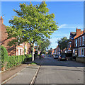
Lady Bay: along Gertrude Road
Typical red-brick Bridgford villas, photographed on a sunny September morning.
Image: © John Sutton
Taken: 17 Sep 2019
0.11 miles
9
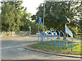
Lady Bay Home Zone
The blue sign and the figures on the road surface are the only indications that you are entering a 20mph zone. This is the edge of the main built up area.
Image: © Alan Murray-Rust
Taken: 2 Jul 2009
0.12 miles
10
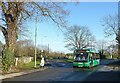
Starting for the City Centre
Nottingham City Transport's Optare Solo no.333 has just left the turning circle to return to town. It fits nicely in the short section of sunlight between the long December shadows.
Image: © Alan Murray-Rust
Taken: 10 Dec 2021
0.12 miles