
IMAGES TAKEN NEAR TO
Gertrude Road, NOTTINGHAM, NG2 5BY
Introduction
This page details the photographs taken nearby to Gertrude Road, NG2 5BY by members of the Geograph project.
The Geograph project started in 2005 with the aim of publishing, organising and preserving representative images for every square kilometre of Great Britain, Ireland and the Isle of Man.

There are currently over 7.5m images from over14,400 individuals and you can help contribute to the project by visiting https://www.geograph.org.uk
Image Map
Images are licensed for reuse under creativecommons.org/licenses/by-sa/2.0
Notes
- Clicking on the map will re-center to the selected point.
- The higher the marker number, the further away the image location is from the centre of the postcode.
Image Listing (70 Images Found)
Images are licensed for reuse under creativecommons.org/licenses/by-sa/2.0
Image
Details
Distance
1
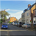
Lady Bay: exceptions on Gertrude Road
In an area of staid and generally rather plain red-brick Victorian and Edwardian villas the florid frontages on the right are exceptions.
Image: © John Sutton
Taken: 17 Sep 2019
0.03 miles
4
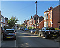
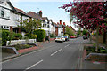
Lady Bay: Gertrude Road
A cloudless September morning.
Image: © John Sutton
Taken: 17 Sep 2019
0.06 miles
6
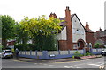
Rendered wall outside #156 Holme Road at Gertrude Road junction
Image: © Roger Templeman
Taken: 12 May 2018
0.07 miles
7
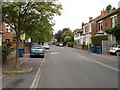
Julian Road, West Bridgford
Typical street scene for this area of West Bridgford.
Image: © Oxymoron
Taken: 7 Aug 2008
0.07 miles
8

Antique advertising
These Hovis bread signs were once a familiar sight. This one remains on the first floor of a shop on the corner of Trent Boulevard and Gertrude Road.
Image: © John Sutton
Taken: 1 Jul 2009
0.08 miles
9
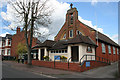
All Hallows Church, Lady Bay
On Pierrepont Road.
The first church on this site was a corrugated iron mission building erected in 1898. In 1901 a brick extension was added, and in 1906 the iron building was re-sited, to become the church hall, and the brick church was completed. In 1950 All Hallows was consecrated as the Parish Church for Lady Bay, the area between the River Trent and the A52 and the Grantham Canal.
Image: © Kate Jewell
Taken: 1 May 2008
0.09 miles
10
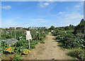
West Bridgford Allotment Holders' plots, Holme Road
The flats on the other side of the river (see Image] and other photographs) show on the skyline to the left of centre.
Image: © John Sutton
Taken: 27 Jul 2022
0.09 miles