All Hallows Church, Lady Bay
Introduction
The photograph on this page of All Hallows Church, Lady Bay by Kate Jewell as part of the Geograph project.
The Geograph project started in 2005 with the aim of publishing, organising and preserving representative images for every square kilometre of Great Britain, Ireland and the Isle of Man.

There are currently over 7.5m images from over 14,400 individuals and you can help contribute to the project by visiting https://www.geograph.org.uk
All Hallows Church, Lady Bay
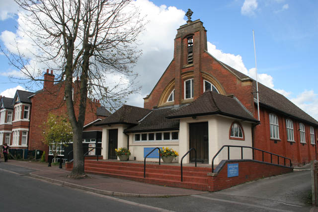
Image: © Kate Jewell Taken: 1 May 2008
On Pierrepont Road. The first church on this site was a corrugated iron mission building erected in 1898. In 1901 a brick extension was added, and in 1906 the iron building was re-sited, to become the church hall, and the brick church was completed. In 1950 All Hallows was consecrated as the Parish Church for Lady Bay, the area between the River Trent and the A52 and the Grantham Canal.
Images are licensed for reuse under creativecommons.org/licenses/by-sa/2.0
Image Location
Latitude
52.939544
Longitude
-1.11863