IMAGES TAKEN NEAR TO
Beanford Lane, SOUTHWELL, NG25 0SF
Introduction
This page details the photographs taken nearby to Beanford Lane, NG25 0SF by members of the Geograph project.
The Geograph project started in 2005 with the aim of publishing, organising and preserving representative images for every square kilometre of Great Britain, Ireland and the Isle of Man.

There are currently over 7.5m images from over14,400 individuals and you can help contribute to the project by visiting https://www.geograph.org.uk
Image Map
Images are licensed for reuse under creativecommons.org/licenses/by-sa/2.0
Notes
- Clicking on the map will re-center to the selected point.
- The higher the marker number, the further away the image location is from the centre of the postcode.
Image Listing (10 Images Found)
Images are licensed for reuse under creativecommons.org/licenses/by-sa/2.0
Image
Details
Distance
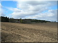
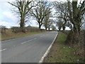
2
Beanford Lane
Looking towards Foulds Plantation, established around 1900 as a game covert with pheasantry.
Image: © Alan Murray-Rust
Taken: 6 Jun 2023
0.07 miles
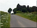
5
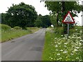
Try your brakes
The classic advisory sign following the passage of a ford.
Image: © Alan Murray-Rust
Taken: 6 Jun 2023
0.20 miles
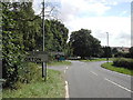
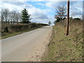
7
Leaving the Oxton roundabout on the B6386 to the west
Image: © Chris
Taken: 29 Dec 2013
0.21 miles
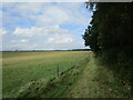
9
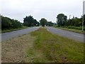
Dual carriageway central reservation
On the A6097 west of Oxton
Image: © Graham Hogg
Taken: 5 Jun 2018
0.21 miles
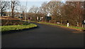
10
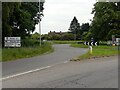
Roundabout on the Oxton By-pass
The B6386 meets the A6097.
Image: © Alan Murray-Rust
Taken: 6 Jun 2023
0.22 miles