IMAGES TAKEN NEAR TO
Oxton Road, SOUTHWELL, NG25 0RW
Introduction
This page details the photographs taken nearby to Oxton Road, NG25 0RW by members of the Geograph project.
The Geograph project started in 2005 with the aim of publishing, organising and preserving representative images for every square kilometre of Great Britain, Ireland and the Isle of Man.

There are currently over 7.5m images from over14,400 individuals and you can help contribute to the project by visiting https://www.geograph.org.uk
Image Map
Images are licensed for reuse under creativecommons.org/licenses/by-sa/2.0
Notes
- Clicking on the map will re-center to the selected point.
- The higher the marker number, the further away the image location is from the centre of the postcode.
Image Listing (11 Images Found)
Images are licensed for reuse under creativecommons.org/licenses/by-sa/2.0
Image
Details
Distance
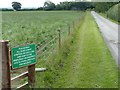
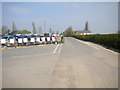
1
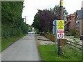
The lane to Thurgarton Quarters
Originally simply a farm access road, it has attracted housing development in recent years. Still a private road, but also a public bridleway, as the notices imply.
Image: © Alan Murray-Rust
Taken: 12 Jul 2020
0.02 miles
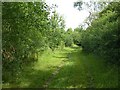
2
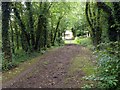
Woodland ride near Holly Beck House
The northern end of the bridleway from Epperstone.
Image: © Alan Murray-Rust
Taken: 12 Jul 2020
0.03 miles
5
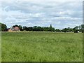
Near Thurgarton Quarters
The houses are modern development along the access to the farm.
Image: © Alan Murray-Rust
Taken: 12 Jul 2020
0.10 miles
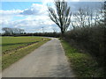
6
Bridleway between Epperstone and Halam
North of Norwood Farm. The woodland is modern development (early 21st century) and the bridleway is a diversion from traditional paths to follow suitable field boundaries.
Image: © Alan Murray-Rust
Taken: 12 Jul 2020
0.13 miles
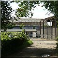
7
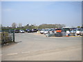
Car park entrance, Hollybeck Garden Centre
Image: © Richard Vince
Taken: 7 May 2016
0.13 miles
8
The lane to Thurgarton Quarters
A main access to various farms, private road but with public bridleway rights.
Image: © Alan Murray-Rust
Taken: 12 Jul 2020
0.14 miles
9
Road past Hollybeck Garden Centre
The entrance to the garden centre car park is on the left.
Image: © Richard Vince
Taken: 7 May 2016
0.15 miles
10
Thurgarton Quarters Farm
The farmyard access. The farm appears to have changed from general agriculture to a stabling facility.
Image: © Alan Murray-Rust
Taken: 12 Jul 2020
0.24 miles