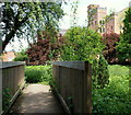
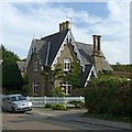
IMAGES TAKEN NEAR TO
Riverside, SOUTHWELL, NG25 0HA

Introduction

This page details the photographs taken nearby to Riverside, NG25 0HA by members of the Geograph project.

The Geograph project started in 2005 with the aim of publishing, organising and preserving representative images for every square kilometre of Great Britain, Ireland and the Isle of Man.

There are currently over 7.5m images from over14,400 individuals and you can help contribute to the project by visiting https://www.geograph.org.uk

Image Map


Images are licensed for reuse under creativecommons.org/licenses/by-sa/2.0
Notes
  • Clicking on the map will re-center to the selected point.
  • The higher the marker number, the further away the image location is from the centre of the postcode.

Image Listing (148 Images Found)

Images are licensed for reuse under creativecommons.org/licenses/by-sa/2.0
  • ...
Image
Details
Distance
1
Riverside
Housing development along the old railway alignment.
Image: © Alan Murray-Rust Taken: 9 Jun 2008
0.01 miles
2
River Greet
Downstream of Caudwell's Mill
Image: © Richard Croft Taken: 7 Feb 2007
0.04 miles
3
River Greet below Caudwell's Mill
With low water flow, the river was surprisingly turbid.
Image: © Alan Murray-Rust Taken: 9 Jun 2008
0.05 miles
4
Southwell, NG25, Notts.
The former Cauldwell's Mill is seen here on the other side of the Station Road/Normanton Road continuation, near to the end of the Southwell (former railway) Trail. This is one end of a riverside walk that passes through the Southwell Community Orchard 5 minutes walk away behind the photographer.
Image: © David Hallam-Jones Taken: 25 May 2013
0.05 miles
5
Old Station house
Originally the terminus of a branch line off the Nottingham - Newark line. The line was extended to Mansfield and was used latterly for coal traffic after passenger services ceased. One gatepost of the old level crossing can be seen. This carries a blue plaque with details of the railway history.
Image: © Alan Murray-Rust Taken: 9 Jun 2008
0.05 miles
6
The Station Master's House, Station Road, Southwell
The railway was opened by the Midland Railway Company in 1847. It closed in 1964. This building, which included a waiting room, was built in 1871 when the line was extended to Mansfield.
Image: © Humphrey Bolton Taken: 25 Oct 2015
0.07 miles
7
Plaque on gatepost of former Southwell Railway Station House
Gives background on the Southwell Railway which is now a linear walk with a public parking area opposite the old station. The Final Whistle PH is close by for those who may be interested.
Image: © El Loco Taken: 6 May 2021
0.07 miles
8
Outfall on River Greet
On the Robin Hood Way
Image: © Chris Morgan Taken: 19 Jan 2015
0.07 miles
9
Southwell Station House
The original stationmaster's house, built when the line from Rolleston was extended to Mansfield in 1871, Listed Grade II.
Image: © Alan Murray-Rust Taken: 13 Sep 2020
0.07 miles
10
Woodland alongside the Greet
Image: © Alan Murray-Rust Taken: 9 Jun 2008
0.08 miles
  • ...